Flood, Fire and Fever
The History of Elwood
by Meyer Eidelson
(see www.skhs.org.au)
See Elwood History Walks
Elwood History Walk: The Poets Triangle
Chapter One: The Elwood Entity
Chapter Two: The Traditional Owners
Chapter Three: The Fever Ship
Chapter Four: Rams and Roads
Chapter Five: Recreation on the Hill and the Beach
Chapter Six: War in Elwood
Chapter Seven: Early Settlers
Chapter Eight: Bushrangers in Elwood
Chapter Nine: From Swamp to Canal
Chapter Ten: Noxious Activities
Chapter Eleven: Early Buildings
Chapter Twelve: Trams to the Rescue
Chapter Thirteen: Shops and Community Services
Chapter Fourteen: A Visit to Elwood Junction 1940s and 1950
Chapter Fifteen: Flats, Flats and more Flats
Chapter Sixteen: Walking Tour of the Art Deco Apartments of Elwood
Chapter Seventeen: Chapter Twelve: Memories

The History of Elwood
Has human life no quality at Elwood? In 1877 this was the heartfelt appeal from the residents of ‘the comical autonomousdreaming kingdom of Elwood’. Their petition to government sought protection from frequent hazards such as flooding, bushrangers, human manure, isolation and stray shellfire. Author Meyer Eidelson tells the fascinating Elwood story from Koorie hunting ground to quarantine station, from swamp to Squizzy bolthole, from rifle range to Poets Corner, from graveyard to boom settlement, from wasteland to modern village. Recorded here also are the heritage of Elwood’s buildings, memories of older residents, an art deco walk, the and a range of essential photos. This book is an indispensable guide for all those who fallen in love with, lived in, or just visited this delightful suburb on the crescent of Port Phillip Bay.
Dedication
For My Daughter Eve, an Elwood Supergirl
ISBN: 0 97560000 5 2
Author: Meyer Eidelson
Editor: Robin Grow
Copyright St Kilda Historical Society 2005 ABN: 25 188 646 275
P.O. Box 177 Balaclava 3183 AUSTRALIA
Inquiries: Email info@skhs.org.au (03) 96909584
General website: www.vicnet.net.au/~hsosk
Publications website: www.skhs.org.au
ELWOOD WALKING TOURS:
Explore the extraordinary built and natural heritage of Elwood with the author of the ‘History of Elwood’ including the canal, the Ormond Road village, the foreshore, architecture and indigenous sites. See Bookings
Email: melbwalks@gmail.com
CONTENTS
ACKNOWLEDGEMENTS
FOREWORD
INTRODUCTION
Chapter One: The Elwood Entity
Chapter Two: The Traditional Owners
Chapter Three: The Fever Ship
Chapter Four: Rams and Roads
Chapter Five: Recreation on the Hill and the Beach
Chapter Six: War in Elwood
Chapter Seven: Early Settlers
Chapter Eight: Bushrangers in Elwood
Chapter Nine: From Swamp to Canal
Chapter Ten: Noxious Activities
Chapter Eleven: Early Buildings
Chapter Twelve: Trams to the Rescue
Chapter Thirteen: Shops and Community Services
Chapter Fourteen: A Visit to Elwood Junction 1940s and 1950
Chapter Fifteen: Flats, Flats and more Flats
Chapter Sixteen: Walking Tour of the Art Deco Apartments of Elwood
Chapter Seventeen: Chapter Twelve: Memories
BIBLIOGRAPHY AND REFERENCE
IMAGE SOURCES
ACKNOWLEDGEMENTS
This book could not have been published without the financial support of the Elwood Community Bank and the enthusiasm of its directors, in particular Liz Johnstone and Alastair Chisholm. The City of Port Phillip engaged consultants Heritage Alliance to review Elwood’s heritage buildings during the writing of this book, a lucky coincidence that provided valuable information. Similar value was also provided by the three volumes on St Kilda’s history previously published by St Kilda Council[1]. The Art Deco Society generously gave permission to include a summary of their publication Elwood Walk. The Margins, Memories and Markers project collated by Julie Shiels collected valuable memories of Elwood, some of which are included. In addition, St Kilda Historical Society ran an Elwood Elders Project to collect oral histories.
Many others contributed their ideas, knowledge and support including Amanda Palmer, Beverley Broadbent, Roger Palmer, Catherine Reiser, Michael Jennings, Kitty Barclay, Cliff Skinner, Helen Graham and many others to whom I am enormously grateful. A particular thanks to Ken Corbett, Robert Davis and Robin Grow. A book of this size is only an introduction and further reading and sources are suggested at the end. My apologies to those that contributed but may not be acknowledged here.
FOREWORD
The history of Elwood is as diverse and surprising as our suburb today.
‘Flood, Fire and Fever’ celebrates the natural, built and cultural heritage of Elwood from pre-European times, to quarantine
stations and coal mines at Point Ormond to the trams that used to trundle past our front door.
By sponsoring this book, the Elwood Community Bank hopes that Elwood residents and visitors past, present and future, are able to gain a better understanding of events that have gone before and how they have shaped our ‘village’ today.
Congratulations to Meyer Eidelson and the St Kilda Historical Society for an excellent publication.
The shareholders, customers and supporters of the Elwood Community Bank hope you enjoy learning more about our village and our community.
We believe that this book will become a valued community resource and copies will be widely available through libraries, local schools………..and at the bank!
Liz Johnstone
Founding Board Member, Elwood Community Bank
Former Councillor and Mayor, City of Port Phillip
January 2006
| Elwood Community Bank, 142 Ormond Road CROP SIDES TO JUST INCLUDE BANK) |
INTRODUCTION
Has human life no quality at Elwood?
This was the heartfelt cry of defiant residents from Elwood seeking redress from government for their common predicament. The swamps regularly flooded, the abattoir dumped offal into the creek and the smell from the human manure depot was not pleasant. Then there was the lack of roads and the bullets that whistled overhead from the rifle range. Elwood was isolated from St Kilda by wetlands, distant from Melbourne for business and residence and the subject of dispute between its neighbouring suburbs. At one point a hostile Brighton simply cut a canal to Elwood’s border and dumped its floodwaters into what early historian John Cooper described as ‘the comical autonomous dreaming kingdom of Elwood.’
Elwood’s early destiny was largely determined by two geographic features, namely the Elster Creek, (now Elwood Canal), and the promontory at Point Ormond, once known as Little Red Bluff.
Fires burned for eons on the bluff where the traditional owners cooked shellfish in middens, signaled other clans and burned back the country with ‘fire stick farming’ to create pastures for kangaroos. Europeans celebrated their colonial successes by lighting beacons on the bluff on many occasions including 1851 and 1988 to celebrate the creation of Victoria and Australia respectively. Humans have occupied Elwood for up to forty thousand years or more. Yet, in a minute fraction of this time, we have travelled from an indigenous landscape to an information age, an extraordinary journey documented in this book.
Fever brought the first large group of settlers to Elwood when the desperate immigrant ship Glen Huntley landed at Point Ormond in 1840, flying the fever flag and initiating Victoria’s first quarantine station and St Kilda’s first graveyard.
Flooding has characterised the history of Elwood. It cut roads to Melbourne in the winter, caused disputes between neighbouring councils, stalled development and aggravated residents even in recent times. As late as 1989 locals could be seen riding surfboards and canoes in Elwood streets when the canal burst its banks yet again.
Despite its history of adversity, a modern suburb now thrives by the bay in one of Melbourne’s most prized locations. Café life in the Elwood Village seems a long way from the flood, fire and fever of earlier days. Coloured lorikeets flock to the green corridors of shady trees, a native forest has been planted on the foreshore and the once despised canal area is undergoing rejuvenation as a haven for walkers and cyclists.
My parents were two of many holocaust survivors who arrived in Melbourne in 1948 to create a family and home with the usual energy of migrants whose future appears far better than their past. As a child I can vividly remember waiting for the bus with the magic sign ‘Point Ormond’ that transported us along Punt Road – shimmering in a heat wave – to the cool blue waters of Elwood.
My father eventually bought an Edwardian house at 21 Docker Street in the 1960s while my mother purchased a home in Ormond Road in 1973 where she still lives, at the age of 85. My love affair with Elwood began when I lived in my father’s home between the 1970s and 1990s. The backyard was converted to a wildlife refuge and every day I experienced Elwood’s fantastic skies, parklands, waterways, promenades and beach. But my sacred site has always been that dome of dreams, the hill at Point Ormond. Here one can scan Hobson’s Bay for dolphins and seals, regard other Elwoodians at play, view the distant towers of old ‘Smellbourne’, and dream about the life of the Kulin.
Elwood is soaked in memory permeating layers of soil and soul, fissures and cracks, flood and fire, buildings and bridges, the living and the dead, the forgotten and unforgotten. It is the places of our childhoods and our present and our future, our kingdom.
This is the story of that ‘comical dreaming kingdom’.
THE ELWOOD ENTITY
If stately houses we erect,
And therein think to take delight,
On what a sudden we are checked,
And all our hopes made groundless quite!
One little sparks in ashes lays
What we were building half our days.
Thomas Ellwood (1639-1713)
The suburb of Elwood is located eight kilometres south of Melbourne in the City of Port Phillip, on the crescent of Hobson’s Bay between the seaside suburbs of Brighton and St Kilda.
For eighty years Elwood was the south ward of St Kilda but who has ever called it South St Kilda? It has always retained a distinctive identity due to its beginnings as a suburb that no one really wanted. Charles La Trobe, the Superintendent of Melbourne, had trained as a minister as well as being a poet, musician and artist. He first found a use for Elwood when he galloped down to Point Ormond to select a quarantine site for a plague ship in the autumn of 1840. He was apparently inspired to name this isolated, windy and beautiful place after a poet and religious rebel.
Thomas Ellwood’s life and times is vividly described in his autobiography ‘The History of the Life of Thomas Ellwood, Written by his Own Hand’, including descriptions of the English prisons where he was confined for following the Quaker faith. He was the educated son of a bullying Oxfordshire squire, but threw in his lot with the radical ‘Friends’ who proclaimed the equality of all people. He was a close friend of Quaker leader William Penn, to whom the King of England granted Pennsylvania in 1681 where Ellwood City stands today. Ellwood’s ‘A Collection of Poems on Various Subjects’ was published in 1710. He was employed as reader to the blind poet, John Milton, a fact which encouraged St Kilda Council in 1857 to start naming local streets after other poets.
If Elwood had a totem it would be the magpie. In early days hundreds of magpies could be seen digging for worms on the Elwood flats. They influenced the Treasurer of Victoria, Charles Ebden, to give the name ‘Elster’ (meaning magpie in his German native tongue) to his first home in South Elwood. This was the source name of Elster Creek, today Elwood Canal, and for the suburb of Elsternwick.[2]
The Elwood suburb’s boundaries follow Dickens Street, south at Brighton Road, west at Glenhuntly Road, St Kilda Street, Head Street and the foreshore (see map).
Map of Elwood full page
Robert Hoddle, who laid out the streets of Melbourne in 1836, surveyed Elwood fourteen years later, assisted by Henry Foot. His plan marked out what was then North and South Elwood near today’s Ormond Esplanade. In 1883 surveyor John Vardy produced a book of maps that marked every house and street in Elwood and provides a benchmark for the heritage studies of today.
The first land sales occurred south of Point Ormond in 1851. By the mid-1860s the original Elwood was still a small hamlet on swampy ground, with a few properties on the higher ground south of the Point. The new precinct of St Kilda (created in April 1855), and Brighton both cast ambitious eyes over Elwood but feared the expense of public works necessary to build roads and drain the swamp. Instead St Kilda Council saw opportunities, particularly at the beach end of Barkly Street, for unpopular activities such as the abattoir, rifle range, night soil depot and municipal tip.
During the 1860’s the handful of residents managed their affairs autonomously through a small committee of management. On 29 August 1870 Elwood was officially incorporated into the borough of St Kilda (which had been proclaimed a municipal district in 1855) but for many years residents of this semi-autonomous ‘seashore kingdom’ continued to enjoy the unique benefit of not paying rates. This only increased the reluctance of council to spend money on improvements.
Simmering tensions over Elwood’s treatment as a wasteland provoked threats of secession by the independent-minded residents. In January 1877 a delegation met with the State Commissioner of Lands to complain about the neglect of Elwood, including the night soil depot, abattoir, rifle range, undrained swamp and lack of roads. Agitator Samuel Griffiths complained: ‘Was human life of no value at Elwood?’
The unhappy delegation returned after being stirred up at a June meeting chaired by Brighton MP, Thomas Bent, at the Elsternwick Hotel. This second delegation proposed that Elwood be severed from St Kilda and joined to Brighton. The Chief Secretary agreed but called for a vote to ensure that the majority of residents were in favour. Tensions ran high and the future of Elwood hung in the balance but cooler heads prevailed. The residents withdrew their petition after the council offered to complete the road from Elwood to Brighton.
After the sale of reclaimed swampland at Elwood began in 1905, the residents petitioned St Kilda Council to create a new and fourth council ward in St Kilda. The city engineer, Carlo Catani[3], drew up the plans and the former ‘comical dreaming kingdom of Elwood’ officially became South Ward on the 8th April 1914. (Footnote 4: A suburb by any other name. Municipal boundaries have been subject to many reorganisations over the years. South Ward also included Ripponlea and Elwood once extended south to the Brighton Baths. Today the suburb lies within the Elwood/Ripponlea neighbourhood precinct of the City of Port Phillip and Ormond and Blessington Wards. See Melway page 67 for suburb and 3184 postcode boundaries. J Hewison, H McDuigan and Burnett Gray were elected as the ward’s first councillors shortly before McDuigan and Gray went off to the Great War. The latter is celebrated today by the name of the Burnett Gray Infant Welfare Centre on the Broadway.
At 649 acres, the new ward was the largest in St Kilda but had the smallest population. There were 4,446 residents of whom only 1,611 were ratepayers entitled to vote. The council valued the entire ward at £49,898 (less than half the price of a flat in 2005) but hoped for a future valuation of an unheard of £83,493. Elwood remained part of the City of St Kilda until 1994 when it joined the new City of Port Phillip after the Kennett Liberal Government legislated to amalgamate local governments.
Today the most optimistic evaluations of Elwood have been more than fulfilled. Elwood has become one of Melbourne’s most desirable locations in which to live. Between 1987 and 1996, median property prices rose to an astonishing 205% of the metropolitan median.
However, we are getting ahead of ourselves. To tell the Elwood story we must leave modern real estate and return to the suburb’s beginnings as a clan estate of the Kulin Nation.
THE TRADITIONAL OWNERS
The City of Port Phillip acknowledges the people and the elders of the Kulin Nation who have traditional connections and responsibilities for the land, which the Port Phillip Council now occupies. Memorandum of Understanding, City of Port Phillip 2004
The occupation by indigenous people for up to 40,000 years or more of the area now called Elwood is largely unrecorded. This short summary is compiled mainly from records kept by writers, settlers, botanists, and protectors after the settlement of Melbourne in 1835.
Frederick Revans, a Supreme Court judge in New Zealand, arrived as a boy in Melbourne in 1854 and later published his reminiscences in the Victorian Historical Journal of the Royal Historical Society. Amongst his memories, he recalled an event in Elwood:
I remember our excitement when one day, probably in 1857, two hundred blacks from Gippsland arrived suddenly in Hotham Street, trooping towards Elsternwick. An hour or two later, a solitary female appeared, and we gave her something to eat. She followed the tracks of the tribe in the dusty road, and when we asked her if she could see her husband’s tracks, she pointed them out to us amid hundreds of others, and started to follow them at a run, pursuing an irregular course such as he had taken when carelessly strolling with the mob. In the evening we followed the blacks, hearing that they were going to hold a corroboree, and found the whole tribe camped at a place where the trees were fairly thick. There were no residences near, save for a house or two along Brighton-road, some distance away. I think the spot must have been somewhere not far from where, in later years, Sir Frederick Sargood built his fine house (Rippon Lea). Here we stayed until midnight, mixing with the blacks, listening to their chants, and watching the strange and grave dances of the corroboree circle.
Archaeological records indicate that Point Ormond was a campsite for the traditional owners. A midden was recorded in the vicinity in 1974, apparently during the redevelopment of the road junction at Barkly, Glenhuntly and Ormond Esplanade. Middens are former cooking sites containing charcoal, shells, bone and stone flints, often of great size and antiquity. These shells were probably harvested from the reef just offshore beyond the point. Mrs Huon/Dougharty (1858-1929), who resided in Elwood House in Vautier Street, recalled: Aboriginals came to the Red Bluff, the sands thereabouts containing large beds of cockles.
Stone axes were also recovered from the Point Ormond area in the 1970s. (Footnote 5: In about 1973 roadworks were undertaken at Robinson Reserve behind Point Ormond near the junction of Glenhuntly Road and Barkly Street. Marine Parade was extended south to join Ormond Esplanade splitting the reserve. Glenhuntly Road was extended west to join Marine Parade. These works apparently uncovered an Aboriginal midden from which two stone axes and possibly other tools were recovered.) Such axes were an essential tool of all adult males. St Kilda was known by the name Euro Yroke or the ‘grinding stone’ area for the red sandstone in the St Kilda area used to sharpen stone axe blades. The red and yellow sandstone at the bluff may have also been used for ochre. The Point would also have offered an excellent strategic lookout for hunting animals and for signaling other clans.
According to George Robinson, the Aboriginal Chief Protector in the 1840’s, the Yalukit willam clan of the Boon wurrung tribe were the occupants of the coastal tract at the head of Port Phillip Bay including Elwood. Derrimut, a well-known arweet or leader of this clan, has been credited with saving the first settlers on the Yarra from attack in 1836. He died in 1864 and his memorial stone is located in the Melbourne General Cemetery. Other recorded arweet of the Yalukit willam clan included Eurernowel and his sons Par-tour-weer-rop, Bullourd and Mangerer.
Wetlands like the Elwood swamp provided a rich abundance of food for the clans including tortoises, ducks, eels, frogs, fish, and freshwater shellfish. Wetland plants provide many edible roots from which starch can be extracted to make damper. As little as four to five hours a day’s foraging may have been sufficient to meet family needs.
Elwood occupies the fringe of Hobson’s Bay which was recalled by Aboriginal people in the nineteenthcentury as a hunting or ‘kangaroo ground’ before the sea broke through the Heads at the end of the last Ice Age about 9,000 years ago. During the Ice Age, Hobson’s Bay was a plain across which the ancestors of the Kulin could have walked to Tasmania. A Dreamtime story tells how Bunjil, the ancestral creator, placed sacred rocks in the area now known as St Kilda to stop the approach of the sea during the great flood. Perhaps these sacred ‘rocks’ included the bluff at Point Ormond.
Corroborees at nearby Emerald Hill (where the South Melbourne Town Hall now stands) were recollected and painted by Wilbraham Liardet. In 1840 Richard Howitt described fifty men dancing there assisted by the musical accompaniment of women as a performance to ‘haunt the soul for years afterwards’. Clans also reputedly gathered at the nearby Corroboree Tree, an ancient river red gum at St Kilda Junction.
By the early nineteenthcentury, time was running out for the Koories. The clans on the foreshore of Port Phillip faced the loss of their physical and spiritual connection to their lands, as visits by European vessels to Victoria became ever more frequent. In 1802 Charles Grimes led a surveying party from Sydney to Port Phillip aboard the ‘Cumberland’, recorded the presence of the Elwood swamp and sighted two emus. Shortly after Christmas Day of the same year, convict William Buckley fled past Elwood after escaping from a short-lived British settlement at Sorrento. In 1835 John Fawkner’s vessel, the Enterprize, dropped anchor at Point Ormond en route to the Yarra.
The European adventure would soon turn the landscape into an environmental nightmare. Diseases brought by Europeans would also prove to have a devastating effect on the Aboriginal population. Only five years after settlement a plague ship was unloading its passengers on the campgrounds of the traditional occupants of Elwood.
| Jimmy and Nancy Dunbar, two well known members of the Boon wurrung (photo) |
THE FEVER SHIP
‘They dared the perils of the sea
To win with hope the promised land
To find new homes was not to be
But lonely graves upon its strand.
Hymn sung by St Martin’s choir at the reburial of Scottish emigrants exhumed from Elwood in 1898
Point Ormond, at the south end of Elwood beach, presents as a peaceful haven for children, walkers, cyclists, kite-flyers and picnickers on the lawns. However soon after settlement, it was witness to tragic circumstances – the arrival in 1840 of the fever ship Glen Huntley. This event precipitated Victoria’s first quarantine station, St Kilda’s first graveyard, and the eventual naming of Glenhuntly road, suburb, road, and railway station. (Glenhuntly Road was once called ‘Typhus Road’ until residents begged for a change).
Settlers in Australia were encouraged to sponsor immigrants with a bounty for special classes of workers. Merchants made fortunes chartering vessels that crammed as many people on board with insufficient food and scant attention to comfort. The Glen Huntley was specially built to take advantage of these profitable immigration schemes and was on its maiden voyage.
Family descendant, Olive Moore, describes this ill-fated journey in her book, Flying the Yellow Flag. In December 1839, the barque of 430 tons left Greenock and Oban, Argyleshire, Scotland with 157 government emigrants bound for Australia. When she arrived at William’s Town on 17th April 1840, Melbourne was extremely alarmed to learn that the Glen Huntley was a fever ship, ten emigrants having died during the voyage. Typhus was already raging in Hobart Town at the time, and many cases were reported in Sydney. Governor La Trobe ordered Captain Buchanan to anchor off Point Ormond, then considered remote from Melbourne. Tents were set up and rudimentary comforts were provided for the unfortunate emigrants, who disembarked on 23rd April.
A Sergeant and four Privates guarded the emigrants to ensure that they did not come in contact with other settlers. There were two camps, one for the fever patients and one for those emigrants free from disease. Surgeon Superintendent Browne was in charge of the sick camp.
The healthy camp was controlled by Dr. Barry Cotter, who reported that upon landing six fresh cases of fever were found. This left 108 persons including children in the healthy camp, many emaciated from the long and arduous voyage. To make matters worse the canvas camp was very exposed to the bitterly cold and wet weather. One healthy emigrant, Ann Cummins, fell from the cliff onto the beach and was badly injured. Superintendent La Trobe made frequent visits to the camp.
The first death at the Point was of a young single man, James Mathers, on 22nd April. John Craig, a weaver from Paisley, then died leaving a wife and seven children. George Armstrong, an old man, died of dysentery. All three were buried in the crown of the bluff on 23rd April. The camp was inspected on 27th May and the healthy emigrants were released from quarantine on 1st June. On 13th June, the remainder were allowed to go to Melbourne.
The quarantine station was closed in the 1850’s and its operations were transferred to Portsea. For half a century the graves, enclosed by a picket fence, marked the place of tragedy and gave the bluff an air of mystery to later settlers. In 1877 Amie Stirling recalled: ‘There were no trees or flowers on the bluff, only two large granite slabs where two shipwrecked sailors had been buried. There were no names on the slabs, only the date which I do not remember. My mother wrote a poem called ‘The Nameless Sailors Graves.’
| Early Graves on Point Ormond |
The sea gradually undermined the bluff threatening the site. The graves were re-opened in the presence of the civic authorities of St Kilda and representatives of government at 7 am on the 27th August 1898. The red gum coffins, made in 1840, had turned to dust, but the skeletons of the bodies were almost intact. The remains were put in three coffins and in the afternoon were buried in the St Kilda Cemetery in the presence of the councillors and relatives of those who came in the ship Glen Huntley. Mrs. Bowman, a daughter of John Craig, was a child of eight at the time of the tragedy and stood for the second time at the grave of her father. Public subscriptions allowed a suitable memorial to be erected.
On 7th November 1985, a plaque commemorating the Glen Huntley pioneers was unveiled at Point Ormond in the presence of descendants of the original voyagers. Subsequent reunions were also held including on St Kilda Heritage Day, 13 April 2003, when a reception was provided by the City of Port Phillip in the St Kilda Town Hall.
These early events are stark reminder that settlers in new areas like Elwood were overwhelmingly comprised of Scottish, Welsh, Irish and English immigrants and their children, many of whom had fled from poverty by extraordinarily hazardous means. A major cause of this poverty was the Enclosure Act in England that forced crofters off their common lands to make way for large-scale sheep farming.
Ironically, it was the global wool trade with its need for new grazing lands that initiated the settling of Port Phillip by Tasmanian pastoral syndicates led by John Fawkner and John Batman. As a result the vast majority of newly arrived occupants of Elwood after settlement would prove to be sheep and cattle.
| Unveiling the official Memorial at St Kilda General Cemetery after burial of remains from Point Ormond in 1898 |
RAMS AND ROADS
Elwood’s first European occupants were mainly imported livestock. Early St Kilda was sometimes described as a village in the middle of a cattle run. Shortly after settlement, the colonial government, stationed at Sydney, leased the lands of Port Phillip as grazing areas for cattle and sheep. These were driven overland from NSW or arrived by ship from Tasmania. Archibald McLaurin and his brother had a lease in 1836 to graze sheep from Caulfield to Point Ormond, then known as the ‘Red Bluff’.
In 1839, Captain Benjamin Baxter was granted a lease of land to graze cattle from Point Ormond as far as Port Melbourne, virtually the entire foreshore of the City of Port Phillip today. The first known building in St Kilda was his stockman’s hut marked today by a plaque in Alfred Square. Baxter was a former British commissioned officer in India and Jamaica. He and his wife Martha resided initially in John Batman’s house and then in Flinders Lane where they ran Melbourne’s post office in 1838. Perhaps Baxter’s change of occupation to grazier was prompted by the rescue of Martha from the post office by rowboat during one of Melbourne’s early floods.
There were many disputes over trespassing livestock as the crown and council leased land without consulting each other. A seven-foot fence had to be built around the official town grazing area in what is today the St Kilda Botanical Gardens. In 1866 householders delivered their cows by 8 am to the mustering ground near today’s Village Belle Hotel, paying sixpence for up to six dairy cows. They had to pick them up by 4 pm or pay an extra sixpence to have them delivered back home.
Cattle Grazing at Elwood near St Kilda Beach
Livestock and their owners travelled on various routes in and out of St Kilda. The main livestock route to Gippsland, via St Kilda Junction, is today known as Dandenong Road. Many foot tracks made by the traditional owners were in evidence around the Bay at the time of settlement. Whether and how they became colonial roads is unclear but by 1842 a well-defined bush track led to Elwood from St Kilda and then on to Brighton, a hamlet of about 600 residents. This bush track extended the line of St Kilda Road (formerly known as Baxter’s Track) straight over the hill becoming High Street and Brighton Road. On March 10th 1848, Mrs. Perry, the wife of the first Anglican Bishop of Melbourne, described this road in a letter to her friends in England:
It was along a deeply sandy road full of tree stumps, and the surrounding country pretty thickly strewn with gum trees and wattle or mimosa, some dead, some half dead, some in full vigour, some standing upright, some prostrate, some leaning in grotesque attitudes. There is not the slightest approach to underwood to be seen anywhere, and from the appearance of the grass in its present perfectly yellow state I should say it was closely nibbled by sheep. Indeed it is a marvellous country-it appears to be one interminable park.
St Kilda Hill determined the choice of track to Elwood. The track up High Street was the most direct route south but the climb was a drawback to most travellers. For many it was easier to take the lower track, which diverted at St Kilda Junction to the west side of the hill. Old maps show the track running down what today is Fitzroy Street, with a swamp (Albert Park Lake) on its north side and the hill on its south side to the corner of the Esplanade and Fitzroy Street. It then forked into two roads known as the Upper Road (today The Esplanade) and the Lower Road (today Jacka Boulevard).
The road which had to be roughed out through the tea tree to the cleared space of the Quarantine Ground became possibly Elwood’s earliest road, called Quarantine Road (now Marine Parade). The tea tree and other native fauna quickly fell prey to damage caused by livestock and clearing for firewood. One of the earliest residents, MP John Dougharty of Elwood House, appointed himself honorary ranger to stop the rampant tree-felling and the government moved to set aside public reserves for the recreation of citizens. The earliest of these initiatives were to be concentrated between Elwood beach and the bluff at its northern end.
RECREATION ON THE HILL AND THE BEACH
A flagpole, maybe seven metres in height, was positioned on the peak of Point Ormond hill where the wooden marker is now situated. There could also have been a circular seating arrangement at the base of the flagpole. On the eastern side of the hill was Point Ormond Kiosk, which was quite large in size and really a tearoom. It was very dilapidated in appearance. It smelt musty at all times and even the tearoom staff seemed quite ancient. On the western side of the hill commenced a pier 40-50 metres in length. The structure was destroyed in a storm during the 40’s or maybe 50’s. It was popular with fishermen, there being some excellent catches of flathead. On the southern side at the base of the hill operated a team of Shetland ponies every Sunday afternoon, summer and winter. A brief oval ride whilst being led cost threepence.
On the northern side I recall on a cold and miserable evening an army display at the bottom of the hill, which I think was for the purpose of selling war bonds. The highlight of the display was the demonstration of a flame-thrower mounted on a tank or Bren Gun carrier. In those days the tea tree growth was much thicker. During the war when I was a student at St Columba’s, we were taken to the ‘forest’ to practice air raid drills when our nation felt most at threat around 1943. St Columba’s was occupied by U.S troops while we were displaced into a tennis pavilion seated three to a desk.
Ken Corbett who grew up in Elwood from 1934 to 1957
Elwood Beach extends north from its border with Brighton at Head Street to the green prominence at Point Ormond. These 54 acres of land adjacent to the beach and extending east to Ormond Esplanade were reserved as a public garden early after settlement. Residents successfully fought off an attempt by the Government to sell the reserve for development in 1865. Included at the southern end of the reserve were eleven acres of rifle range that became Elwood Park in 1907.
Swamp reclamation and tramways extensions in the early 20th century kick-started Elwood Beach’s transition to one of Melbourne’s most popular recreational areas for families. The Elwood Surf Life Saving Club was founded in 1913, building premises at Head Street in 1921. In 1971 it moved to its current premises designed by noted architect Don Fulton in striking ‘Brutalist’ style. Today it serves as local lifesaving club, bathing pavilion and the State Disaster Headquarters for all marine emergencies on Port Phillip Bay.
The oldest structure on Elwood Beach is the delightful octagonal weatherboard kiosk (1915) opposite Normanby Street that has provided refreshments to bathers and visitors for an extraordinary nine decades. In 1924 the clubhouse of the first Sea Canoe Club in Australia was erected and later became the Elwood Sailing Club in 1939. Other recreational facilities followed including the Croquet Club (1937), and a Sea Scout hall (c1958).
Elwood Beach Kiosk
By 1930 spacious tearooms were being operated by confectioner John Wharton at Point Ormond, on the west side of Marine Parade, near Glenhuntly Road. It was demolished with the nearby jetty in the 1950s. In the 1930’s and 1940’s, council minutes recorded the shocking news of the public breaching restrictions by swimming in their bathers. The seabathing pavilion was demolished in 1971.The advent of motorcars saw Elwood beach, with its car park, supplanting older beaches as a premier destination. The historic Elwood Angling Club moved from Prahran in 1939 and was rebuilt in 1957 after a fire. The Elwood Bowling Club (1925) on the foreshore opposite Vautier Street was converted to the Beach House Community Centre and Café in the 1990s. In about 1931 public tennis courts were built. A soccer facility followed later.
At the northern end of Elwood Beach, a wooden navigation tower sits atop a gently sloping hill beside a park and playground. Peel back the multiple cultural layers of this peaceful place and you have a snapshot of the whole history of Elwood. Originally known as Little Red Bluff, the place name of Point Ormond was named for Captain Ormond, who visited Port Phillip in 1839. He returned to England and bought a small ship to bring out his family, including Francis, his son. Francis rose from early employment as a stable boy to become a large landowner and a great philanthropist. The suburb of Ormond is named after him and his statue stands in front of the Melbourne Working Men’s College, later Royal Melbourne Institute of Technology.
In August 1835, Elwood had a brief opportunity to become the centre of a great metropolis when the Enterprize, John Fawker’s schooner, dropped anchor at Elster Creek. Fawkner later described the scene:
Each side of the red bluff (now Point Ormond) was a small inlet or bay. The one on the north…formed part of a basin into which a watercourse poured its floodwaters. The sinuous line of the watercourse was marked by fringing wattle and small gum trees. Slightly to the north, extending east alongside the stream, was a large marshy lagoon, with an outlet to the sea.
Point Ormond sketched by Elizabeth Parsons in 1875. Note distant gravesites on the bluff and the Elster Creek (today Elwood Canal) in the foreground.HALF TO WHOLE PAGE
The crew was insufficiently impressed to stay for long and sailed on to the Yarra where they founded Melbourne after unloading near today’s William Street. In the early decades the Point was a prominent landmark for shipping and by the 1850s was gaining popularity as a summer picnic spot. Since 1985 there have been several reunions of descendants of the Glen Huntley fever ship at the site of the former quarantine station of 1840.
Fire is a recurring motif at the point. Cooking fires of the traditional owners burned here over thousands of years. Beacons were lit on the Point in 1851 to celebrate separation from NSW. In 1863, Albert Edward, Prince of Wales and eldest son of Queen Victoria, married Princess Alexandra of Denmark. Seventy tons of firewood plus barrels of tar and oil casks were hauled to Point Ormond and lit on 10 March to celebrate the event. In 1998 Australia’s bicentenary was commemorated by a ‘ring of fire’ – the lighting of beacons around the entire Australian coastline, including one at Point Ormond.
The bluff was a favourite subject for paintings by artist, Elizabeth Parsons (1831-1897), who has left us many exquisite images. Her paintings around 1875 show the hill as a cliff or headland, not the gentle mound we see today. In the 1890’s spoil from the bluff was used to reclaim Elwood marshlands. In 1904 the seaward edge was cut down to 2.4 metres, despite bitter opposition, to create a seawall and extend Marine Parade. The remaining bluff was then graded to a slope reducing its height by several feet.
An abattoir and coal mine were built nearby, the former provoking protests until it was closed in 1898. The Point Ormond Improvement Scheme began on 25 May 1915 providing work for the unemployed including the construction of a refreshment kiosk designed by Carlo Catani. On 4 June 1915, a new tramway was extended to Point Ormond, enabling travel from Elsternwick railway station to the beach. The terminus, with a large passenger shelter made of green latticework slats, was next to both the tearooms and the beach.
In 1901, a Signal Station at Point Ormond made history with the first ever radio-telegraph communication to a ship at sea (HMS St George) from the Australian mainland.
On 18 March 1924, thousands of spectators crowded onto Point Ormond hill and the St Kilda foreshore to see the stately warships of the British Fleet enter Port Phillip Bay. They rapturously welcomed the visible evidence after the Great War that ‘Britannia was still the Mistress of the Seas’ and basked in the ‘protective kinship of the British Empire to its outlying dominions.’ Twenty-two aircraft flew overhead and a choir of seven hundred children from St Kilda’s two state primary schools sang Rule Britannia.
The Point has also been a focus for the arts. Actors Gregory Peck and Ava Gardner were there in 1959 for the filming of On the Beach, a movie about a nuclear holocaust in the future – 1964! In 1984 the Point also featured in the final scene from A Man of Flowers starring Norman Kaye.
In the 1970’s roadwork excavations apparently uncovered a midden revealing that the point was a former campsite for the traditional owners. In 1989, local residents alleged that a UFO had landed at the point leaving a scorched circle. An amazing passage from a stone-age site to an outer-space heliport in a mere 150 or so years.
One of the lesser-known uses of public land on Elwood’s beachfront was for military purposes. In the immediate aftermath of the gold rush, Melbourne was full of the yellow mineral and full of fear of its loss. Elwood was to be a key area called upon to defend the unfortified city from imagined invaders.
WAR IN ELWOOD
‘Forward, the Light Brigade!’
Was there a man dismay’d ?
Not tho’ the soldier knew
Some one had blunder’d:
Their’s not to make reply,
Their’s not to reason why,
Their’s but to do and die:
Into the valley of Death
Rode the six hundred.’
The Charge of the Light Brigade by Lord Alfred Tennyson
Tennyson Street, Elwood celebrates the romantic poet who wrote The Charge of the Light Brigade describing a bungled advance during the Crimean War in 1854. Elwood is a long way from Crimea but this war heightened fears by the colony of Victoria about their ability to repel invasions from the sea while Britain’s attention was elsewhere. As a result by 1859 there were three rifle butts on the beach between Elwood and St Kilda. Eleven acres were allocated to a rifle range with the targets near Head Street.
A volunteer artillery regiment was recruited and in 1860 built fortifications north of Point Ormond using earthworks, gabions, and sandbags to set up a field battery of 32-pound muzzle loading guns. To simulate wartime conditions, the men slept on Elwood beach. For a decade, the commanding officer was Captain Sargood, later the Minister of Defence and owner of Ripponlea mansion. His men joked that the SK (St Kilda) on their shoulder straps stood for ‘Sargood’s Kids’. Sargood was heavily criticized for cutting down the tea tree while constructing the military butts. A positive outcome, however, was one of Melbourne’s earliest conservation initiatives when the council was moved to fence the reserve and increased plantings on the foreshore.
On 2 July 1862, up to 1800 militia and troops engaged in military manoeuvres at Point Ormond, with 20,000 onlookers. The Point was ‘attacked’ by a party disembarking from the warship Victoria which was then repulsed by troops using a bridge built by artillery engineers over the Elster Creek (Elwood canal). The only casualty was a horse accidentally shot as a result of the worn muzzles typical of surplus British rifles.
In 1867, it was recommended that submarine obstructions be placed in the shoal water west of Point Ormond under the guard of sixty-pounder guns. In 1871, in ‘an atmosphere of great excitement’, Armstrong forty-pounder breech loading guns were located at Point Ormond to practice firing into the bay.
In 1874, there were complaints to the council when one shell badly frightened people on the main road. It may have been the same or separate occasion that a field gun swung on its moorings from Point Ormond and fired a cannon ball that fell through a washhouse roof in Acland Street into the copper of local Councillor Lord. Major Moule, the battery officer, later explained to a Royal Commission that ‘the volunteer garrison has never been trained to fire a shot at an object in motion.’
Much of the military strategy in Victoria was based on a fear of an attack by Russian forces. The ‘Russian scare’ had other influences on foreshore development of Elwood. In 1887 Mayor Wimpole of St Kilda, lobbied the government for a Military Road on the foreshore from Point Ormond to Port Melbourne to enable artillery to be moved rapidly from battery to battery if engaged in fighting invading ships. It remains today as Beaconsfield Parade and Marine Parade. The project hastened the reclaiming of the Elwood swampland to recover the cost of roadworks.
By the end of the century fears of invasion appeared to have abated. Or perhaps the public had tired of being targets. In any case, the artillery was disbanded while the range was closed and converted to the far more peaceful Elwood Park. The removal of the range was a victory for early settlers like John and Mary Broadbent who had speculated on land in Elwood and had fought vigorously for half a century to bring improvements.
The Local Militia – St Kilda Rifle Corps
EARLY SETTLERS
The Broadbents
Elwood’s First Settlers: The Story of John and Mary Broadbent in Australia 1852 – 1913, was published in 2004 by their great granddaughter, Beverley Broadbent. It is a typical emigrant story of hard work, tenacity and adaptability with much depending on good health and luck.
In 1852 John and Mary arrived in Melbourne from Yorkshire on the Merlin, seventeen years after colonial settlement. They were amongst 86,000 gold rush immigrants that arrived that year. Accommodation was desperately short with seven thousand persons living in ‘Canvas Town’ in South Melbourne. They decided to set up their tent at Point Ormond, later claiming to have been the first and, at the time, only residents of Elwood. John was a carter by trade and cut timber at the Point to meet the huge public demand for firewood.
In March 1854, the Broadbents purchased the first of four lots for a home and farm from speculator Joseph Vautier. (Footnote 6 Today, the original family property is apparently occupied by a block of flats at 16-18 Vautier Street.) It was located on Elwood Hill, a small rise above potential floodwaters. John’s father sent the young couple a portable wooden house by ship from England. Life was challenging with isolation, bushrangers and ‘colonial fever’ that often raged in the summer. Their first child was born in October 1853 but died five weeks later. Three more children soon followed – Thomas, Agnes and Isabella. In 1870 twins, Lucy and Flint, were born to their forty-year-old mother.
In 1860, John became a part time porter for the Melbourne and Hobson’s Bay United Railway Co. He continued to farm in Elwood, as well as buying, renting and selling property. In 1884, he became the station master at Albert Park and later at Auburn Station. His son Thomas joined him eventually rising to the lofty position of stationmaster at Spencer Street in 1904.
Over the years, the family expanded their holdings in Elwood, purchasing thirty investment plots after 1863. They actively supported improvements, lobbying strongly for the railway, the draining of the swamp and the closure of noxious activities such as the abattoir. John represented the residents during a meeting with Thomas Bent MP on 14 June 1877 at the Elsternwick Hotel to propose that Elwood secede from St Kilda and joined to Brighton. This was a tactic to force St Kilda to undertake improvements. In February 1888, a new attempt was made by residents to form a new municipality called Elsternwick. John retired to his home at Elwood in May 1892 and successfully campaigned to close the slaughter yards in 1899. In the same year he was a speaker at the first meeting of the Elwood Railway League, which led a powerful community movement for a rail link to Elwood.
He died at eighty years of age in 1905, the same year that the draining of the Elwood swamp reclamation was completed, and was buried at St Kilda Cemetery. He had witnessed enormous changes to the landscape in his 53 years at Elwood and was responsible for progressing many of them. His son Thomas, (grandfather of Beverley) retired to 21 Tiuna Street in 1916. By 1922 Thomas had sold off the last of his father’s 33 blocks of land. In 2005, a century after John Broadbent’s death, one of these blocks was resold for $1.5 million.
Thomas and Jessie Broadbent with their children c. 1900 HALF OR WHOLE PAGE
The Stirlings
The Stirling family was a relative latecomer to Elwood, arriving in 1887. Their story is notable however because of the remarkable details of Elwood recorded by Amie Stirling in her autobiography: Memories of an Australian Childhood 1880 – 1900.
Amie was only seven years old when she arrived from Omeo with her parents James and Elizabeth, her sister Mary and her brothers Victor, Australia (Alvie), and Kosciusko (Kos). (Footnote 7: James named his children after his passions e.g Amie for the brotherhood of man, Victor for Victor Hugo, Kosciusko for the Victorian Alps that he surveyed as a Lands Officer for Omeo) Her home, Omeo Villa, at 56 Spray Street, was one of the first houses in the new ‘Seaside Estate’ ( Footnote 8: ‘Omeo Villa’ at 56 Spray Street and ‘Lorne’ at 54 Spray Street were proposed for heritage listing by the City of Port Phillip in 2006. They are the only survivors of the eleven villas built in the Seaside Estate between 1880 and 1900.) The bush child was less than impressed with her new home:
Our villa sat on the side of a hill, one of a row all exactly alike. How should I tell them apart? … the front was level with the road, while the back had a flight of steps to go down, from the verandah outside the kitchen. Looking from the back verandah we could see Melbourne in the distance, an uninteresting group of roofs and chimneys. In the foreground was our paddock; farther down were more paddocks, a few scattered houses, and a canal that was being dug to the sea. A bridge was being built and men were working there.
Elwood canal under construction 1889 half page or more
On the first morning her father took her to the bluff where she recalled the small graveyard and saw the sea for the first time:
Before me stretched, as far as my eyes could see, a vista of such beauty as I never dreamed. From that moment I loved the sea with a deep and passionate love.
The Stirlings were a nurturing, literate and artistic family which valued equality of the sexes, love for nature and all fields of learning. James eventually became the Government Geologist of Victoria and was instrumental in the mapping of the brown coal deposits of Gippsland. He was highly regarded for his pioneer research in scientific fields including geology, speleology (caving), ethnography, botany, and meteorology. Elizabeth was an artist who painted and collected specimens for Baron Ferdinand von Mueller, the Government Botanist, who adored the Stirling children and often visited 56 Spray Street. Amie described him: The only German I ever met as a child was one of the most lovable people I have ever known.
The Baron would sit Mary, the small shy sister of Amie, on his knee and say:
This is not a child. She is an elf. See how quiet she is. She does not cry or jump about. She is a pixie, a spirit of the great mountains in a little child’s body.
Her brother Victor was the star pupil of Mr Allingha[?�7???�????!I???5Q???TBf?OQl9d� for Boys. Amie went to Mrs Nesbit’s School for the Daughters of Gentlemen but fell foul of her mannered peers. She was expelled after she organised her fellow students to roll down a hill in an old galvanized old water tank, ruining their clothes. Her younger brother fell from a plank across the canal and she was blamed, leaving her to reflect on discrimination against girls.
One morning in 1888 she woke up to find her bedroom floor under water:
…The day broke on the strangest of sights: water as far as we could see. The houses on lower ground were almost submerged, and people were standing on the roofs. Soon we noticed that the water in our house was receding, and we were able to go out on the verandah. We were cut off from Melbourne, and in a while rafts and boats appeared, manned by policemen who were taking the people off their housetops.
The flood destroyed the sewage system causing a diphtheria epidemic:
People died every day. In the villa next to ours was a family named Reynolds, consisting of father, mother and four children. All died except the mother and youngest child, a baby of 18 months. (Footnote 9: William G Reynolds was a wool merchant. Rate books indicate the family occupied 54 Spray Street between 1888 and 1890, the short period no doubt due to the tragic circumstances.) I was the only Stirling to get the disease.
On her way to school one day, Amie launched herself across the waters in an old box, which soon sank, and she was marooned on a fence post for three hours before help arrived.
In 1893 the family moved to San Remo after James was promoted. Amie eventually took up residence in Canada but, fortunately for this history of Elwood, was persuaded by her son to write her delightful memoirs shortly before her death in 1945.
56 Spray Street, home of the Stirling family from 1888 -1893
The Reverend Joseph Docker (1793-1865) and Elwood House
The energetic life of Joseph Docker is narrated by J. Millan in her book, The Two Lives of Joseph Docker. He was born at Newby Head, Cumbria in England. After working as an assistant curate, he married and immigrated to Sydney in 1828. He was rector of St Mathew’s, Windsor for five years but left after a local campaign to undermine his position. Encouraged by Major Mitchell’s expedition, he decided to travel overland to the Port Philip District. In 1838, the adventurous family travelled to the Murray River in covered bullock-wagons, crossing at Albury, then known as ‘Crossing-Place’.
Docker obtained squatting rights to a run, ‘Bontharambo’ on the Ovens River near Wangaratta, as its owner had deserted after Aborigines killed the shepherds. Docker’s sympathetic approach to the indigenous people was rewarded with their support and they continued to hold corroborees near his house. The homestead prospered and in 1864 he built a granite mansion, also ‘Bontharambo’ which stands today.
In 1855, he built two terraces on one of eleven lots he purchased in the Elwood Hill Estate from Joseph Vautier. Docker lived for a while in one of the terraces and rented the other to stock agent John Dougharty, later a member of the Legislative Council. Dougharty purchased both properties in 1871 and combined them into Elwood House (30/30a Vautier Street), one of Melbourne’s oldest terraces and the oldest house in Elwood.
Docker was a founding settler of Richmond as well as Elwood. There are Docker Streets in both suburbs. He later subdivided his land in Richmond to create the new village of Richmond Hill.
John Dougharty’s daughter, Florence, married Louis Huon in the 1870s and Elwood House was in the Huon family’s possession until the 1920s. Louis Huon’s great-grandfather was a nobleman, Gabriel Louis Marie Huon de Kerrilleau, who fled French Revolutionaries to the NSW Corps in 1794. He formed a liaison with a young French convict transported for theft, who he married after the birth of the first two of their five children. In later years, Florence Huon described her childhood with Elwood covered with wattle trees, hundreds of magpies gathering near Elster creek and her father driving home at night in winter with the waters of Elwood swamp washing over the floor of his buggy.
One of the many challenges faced by Elwood’s first settlers was their relative isolation from Melbourne and their vulnerability to outlaws far from the watchful eyes of the authorities. By the 1850’s the Age newspaper had mounted a vigorous media campaign against the lawlessness and audacity of the bushrangers who stalked the roads leading south from the city.
Elwood House, 30/30a Vautier Street
BUSHRANGERS IN ELWOOD
The road from the city through Elwood to Brighton via St Kilda Junction seems to have been a favourite haunt of bushrangers. They reputedly caroused at the Elsternwick Hotel, a coaching inn established in 1854 to a design by Robert Russell on the corner of Brighton and Glenhuntly Roads. Even two years before the hotel was built, an audacious crime was committed on the sunny Saturday afternoon of 16th October 1852 when bushrangers held up and robbed nineteen citizens in the space of two and a half hours. (Footnote 10: Reported in the Argus newspapers of 15, 19, 20 October and the 1, 2 November 1852.)
William Keel and William Robinson of Brighton were driving in a cart down Brighton Road. After passing the St Kilda racecourse in the vicinity of Glenhuntly Road, they saw two or three men with guns apparently hunting for birds. Suddenly they were surrounded, with guns pointed at their heads and that of their horse. At first they thought the exercise was a practical joke until informed that their brains would be blown out unless they got out of the cart. They were quickly robbed of £28 and £46 and ordered to take their cart into a nearby wattle thicket. Here a halter was cut in shreds and used to tie them together. They were ordered to sit on the ground while two men stood guard over them with double-barrelled guns.
A few minutes later they were joined by two other victims who were also robbed, tied and made to sit down. For the next two and a half hours the bushrangers continued to hold up passers-by, rob and tie them together in the scrub.
After three hours the bushrangers retreated for refreshment to the Busy Bee public house in Little Brighton Road. At dusk they tried to bail up a man passing on a well-bred horse who bolted. Pursued by the bushrangers, he jumped several fences while the less well-mounted outlaws smashed through the same. Skirting the shallow bed of the Elwood swamp, he passed the St Kilda slaughter yard and eventually reached the Royal Hotel on the south end of the Esplanade. James Mooney, the licensee, heard the galloping horse and soon saw a terrified man dismount and enter shouting ‘The bushrangers are after me!’
Mooney’s customers hurried to the open doorway where a glance up the Esplanade confirmed their worst fears. The dusk of the October evening merged into night with armed desperate men prowling the hotel, all outer doors of which were shut and barred. Inside Mooney watched with loaded gun in hand. Soon, the frustrated bushrangers commenced to smash in the door with the butts of their guns. Just as the door panels were beginning to splinter the hammering suddenly stopped and the Mooney’s customers heard cursing and then silence. George Francis, a young man and one of the imprisoned customers, had crept out in the darkness and cut the tethering rope of the bushrangers’ horses and stampeded them.
Just another day in the life of an Elwood commuter in 1852.
This crime in broad daylight was the subject of a famous painting by William Strutt which encouraged the public outcry for greater law and order and hastened the formation of the Victorian Police Force. It also motivated the residents to clamor for works to reduce their isolation from Melbourne. The main focus of their campaign was the Elwood swamp and eventually the government was spurred to action.
| Image: The Bushrangers by William Strutt 1852 LIGHTEN IF NECESSARY |
FROM SWAMP TO CANAL
Miss Camm, having arrived in Victoria in August 1854, went with a party for a picnic to Brighton. They made the journey in a dray. On their return the driver of the dray sought a short cut to St Kilda along the margin of the Elwood Swamp. They were well into the swamp, with its slimy mud bed, when the horses became frightened. The men had to carry the women to the lagoon’s margin, where there was firmer land, and in doing so the men sank into the mud as far as their knees.
From ‘Elwood’s First Settlers’ by Beverley Broadbent 2005
The Elwood canal is a unique seam of open space running through the urban fabric of Elwood. In its former life it was the Elster Creek, which drained to a swamp near the beach. This rare nineteenth century canal has shaped Elwood’s pattern of settlement, its parks and public works, recreational spaces and wildlife habitat. Today the Elwood Canal Master Plan of Port Phillip Council is guiding its restoration from a drain to an aesthetic waterway.
For most of the nineteenth century the wetland was viewed as a barrier to European development. While the subject of complaint for most of its history, it has also been a source of striking recollections, even entering into Australian literature. In his brilliant autobiography, A Fine and Private Place, Brian Mathews describes an epic voyage as a child up the Elwood canal from the foreshore to his home. Leigh Redhead’s crime thriller, Peepshow, culminates in a violent struggle between female sleuth, Simone Kirsch, and a corrupt cop in the ‘oily waters’ of the canal. The brutal murder of Molly Dean in 1930 in a nearby lane off Addison Street was included in one of Australia’s best-known novels, My Brother Jack by George Johnston.
Today, the Elwood Canal is a man-made watercourse connecting the lower reaches of the Elster Creek with Port Phillip Bay, three hundred metres north of Point Ormond. It drains forty square kilometres of southeast Melbourne, including Prahran, Glen Eira and Kingston. The upper reaches of the creek were originally a natural watercourse that ended in an ill-defined wetland near the beach between 108 and 160 acres in size, depending on rainfall.
Elwood Swamp 1886 HALF PAGE OR MORE
Swamps like Elwood, which waxed and waned with the weather, were the natural safety valve of streams and rivers and the source of food and wildlife for the traditional owners. However, European settlement changed all that by using waterways for waste disposal. In 1869 the foul conditions of the Elwood swamp prompted local residents to call for the St Kilda Council to remove the nearby abattoir and night soil depot. Added to their problems, the Brighton Council in the early 1870’s cut a drain through Elsternwick Park to near the swamp’s boundary at St Kilda Street. To prevent Elwood flooding, the St Kilda Council was forced to continue the drain to the Bay, which until 1904 entered the sea about 150 metres north of the canal’s present mouth (near today’s Meredith Street).
Life by the swamp is illustrated by a story told by R. D Ireland, a barrister famous for his defense of the Eureka rebels. Ireland and his friends were by invited by Richard Heales, Premier of Victoria, to dinner at Tennyson Villa (1860) in Tennyson Street. The mansion stood out like a lighthouse on a ‘forest of piles’ in the middle of the Elwood swamp which heavy rain had turned into a lake. Boats conveyed the distinguished guests to the house. Wet and chilled, Ireland bitterly lamented the lack of alcohol (Heales was a teetotaler) until whisky arrived which was immediately quaffed. The whisky turned out to be lemon concentrate, leaving Ireland and his friends choking, inwardly cursing their host and calling for the boats.
There were physical dangers. A beachcomber who sold mussels to buy alcohol stumbled into the poorly lit canal during a storm and drowned, as did journalist Arthur Davies on the night of 31 July 1898.
By 1888 the Mayor and Health Inspector of St Kilda Council found the stench from the swamp to be an ‘intolerable nuisance’. (Footnote 11: 117 years later, on 16 March 2005, Melbourne Water and the City of Port Phillip announced a six-week trial to investigate the sources of odour from the Elwood Canal. Councillor Janet Cribbes said she would be ‘waiting with bated breath to smell the results’.) Sixty men were employed to construct a concrete canal 1.2 kilometres from Glenhuntly Road to Elwood beach. Engineer Carlo Catani (1852-1918), was involved in the design. Mooring rings were provided on the canal’s walls for tying up pleasure boats. Iron girder bridges, supported on brick piers, were initially built at Marine Parade, Barkly, Addison and Ruskin Streets, and Broadway.
Most of the water was supposed to be carried out by pipes on the walls but since they weren’t maintained, all water entered the canal. The canal was also found to ‘float’ and now has six inches of concrete base to anchor it. Additional drains such as the brick drain at Byron Street were connected increasing the overload of water.
Engineer George Higgins was also engaged to drain 134 acres of swamp on crown land. An additional 26 acres of private swampland near Byron Street was drained and subdivided for speculation. An advanced dredge built by Alexey Von Schmidt was imported from San Francisco. Acclaimed by the public as a mechanical marvel, it was mounted on a barge, pumping sand and clay from the Elwood foreshore, mixed with water, into the low-lying swamp areas. Surplus water was then channelled back to the Bay. The canal was also extended from Glenhuntly Road to beyond St Kilda Street. By 1905, the St Kilda Council was finally able to report that the swamp had been filled.
The Dredge ‘Elwood’
Engineer John Monash, later commander of Australian forces at Gallipoli and France, built six bridges across the canal between 1905 and 1907 of which two survive. His first bridge at St Kilda Street is the earliest surviving reinforced concrete girder bridge in Victoria and possibly Australia. This innovative design inspired the use of reinforced concrete for bridge building throughout Victoria. (Footnote 12: His Brickwood Street Bridge also survives upstream in Gardenvale).
Bridge over St Kilda Street constructed by Sir John Monash
The first sales of residential land allotments on the former swamp took place on 21 January 1908. Most of the land adjacent to the canal between Marine Parade and Broadway was sold in 1914, with those adjacent to the canal upstream of Broadway not sold until the 1920’s.
In 1924, the Melbourne Metropolitan Board of Works (MMBW), assumed responsibility. They proposed in 1928 to fill in the entire canal to create ‘rateable’ land but were deterred by the Great Depression.
A polio epidemic in 1937-8 caused many panicked parents to label the canal as Plague Canal and ban their children from the vicinity, including the local school which in 1937 closed from June to September. The MMBW reacted by widening the upper reaches of Elster Creek to improve the flow.
Violent storms showed the canal was ineffective in preventing Elwood from flooding. A record high tide, combined with gales of 100 kpm per hour in December 1934, caused the canal to break its banks, extensively damaging a number of homes. The following year saw flooding close Marine Parade in April and Foam Street inundated in May. In November waves beat on the sea wall, furniture floated in homes and boys delivered papers from rowing boats. In 1955, after another serious flood a project began on a giant diversion drain beginning at New Street, Brighton and emptying into the Bay at Head Street, Brighton to dramatically reduce the flow of water in heavy rain. The dumping of rubbish in the waterway and on the banks by local residents was also of continued annoyance.
By the 1960’s, the canal had begun to improve with re-grading of banks, planting of lawns and renewing access roads, right-of-ways and footpaths. Two new bridges, for north and south-bound traffic on Marine Parade, were constructed across the canal in 1967. These were made possible by the reclaiming of 45 acres of land from the sea, 25 acres of which were set aside for recreation. The remaining 20 acres were allocated for the new St Kilda Marina built in 1969. In 1972 the mouth of the canal, downstream from Marine Parade, was widened and its banks lined with rocks and the adjacent land gazetted as a recreation reserve.
In April 1970, more attention was drawn to the outlet when Prince Charles swam at Elwood and described the water as ‘diluted sewage’. In the same year the MMBW was appointed as the Committee of Management of the land surrounding the canal between Marine Parade and Goldsmith Street. From 1983 onwards, demands from local residents and the council saw it developed it as a linear park to encourage recreation with bike and pedestrian paths connecting to the beach.
The environmental group, Earthcare St Kilda, and local residents agitated for change and undertook plantings with St Kilda Council staff. An Elwood Canal Task Force was established in 1993 from the local community, Melbourne Water and the City of St Kilda, resulting in further works to improve the flow of the canal and the condition of its environs. Flood prevention works have also been undertaken, including the construction of lakes in Elsternwick Park to help with water management. Landscaping along the canal and at its mouth at Elwood beach, including the construction of the John Cribbes footbridge in 1998, have transformed the water feature into a centre for recreational activities.
Today this open canal remains a unique Melbourne landscape and an integral part of the urban character and history of Elwood.
The removal of the swamp was one of the last barriers to improving Elwood’s prosperity. The other barriers were the noxious activities which had had plagued the suburb for most of the 19th century.
Elwood Canal east and west of Glenhuntly Road (2 photos side by side)
NOXIOUS ACTIVITIESIsolated wastelands like Elwood were used to advantage for activities that needed to be out of sight of the public gaze. The establishment of the early quarantine station and graveyard in 1840 set the pattern for the next fifty years.
Participants in illegal bare-knuckle prizefights would meet at the Village Belle Hotel in St Kilda and travel on to Elwood for the main event. On occasion police burst through the bush sending the crowd fleeing in all directions. Hunting events on horseback were popular with the well-to-do, who chased specially released foxes, dingoes and stags across the Elwood flats. In 1857, the Melbourne Hunt Club was given a license to erect kennels for their hounds at Barkly Street near the canal.
In 1857 a human manure depot was also established on Barkly Street near Glenhuntly Road to which market gardeners came to collect manure to feed their crops. Not surprisingly it was closed after strong opposition from locals in 1869. In addition a rifle range was located near Head Street complementing the artillery battery at Point Ormond.
As a result, the experience of bullets whistling overhead was added to the delights of flooding, offal, baying hounds and the smell of human excrement. Not surprisingly Elwood residents have a long tradition of being agitators for change.
It was the abattoir that raised the greatest ire of local residents struggling to increase the value of their land during the 37-year period it was open. By 1861, an open slaughter yard had been established at Barkly Street on a two-acre site on the banks of Elster Creek joined by a timber bridge. An abattoir building, including herding yards floored with stone pitchers and a boiling down plant were later added. In 1884, the manager was Mathias Lyons, ‘a stalwart, shaggy-haired individual’ with a gruff voice he used to restrain his three savage dogs. He lived in a cottage nearby, grew maize crops and had sixty pigs on his unfenced land. Complaints about odour and pollution of the creek were common. In May 1899 a final deputation by aggrieved residents to council was told the long fight was over and the abattoir would close.
(Footnote 13: Ellen and John Lyons, descendants of the Lyons family, still reside in Addison Street beside the former St Kilda abattoir site. Ellen has traced the family history back to County Limerick in 1820. Mathias immigrated to Victoria with his brother, John’s Grandfather. The couples have copies of Mathias’s will in their possession.)
Elwood’s abattoir (brick building centre left) and coal mine ‘Helena’ (right) located in front of Elwood canal at Barkly Street. Point Ormond bluff is at far right.
As late as 1890 residents were also fighting off a proposal by the council to build a municipal garbage destructor in the recreation reserve at Point Ormond.
In 1894, the Victorian Coal Mining Company sank a shaft opposite the abattoir. Coal was in great demand for power and heating. According to the first volume of the History of St Kilda, the company’s actions were guided by a spirit entity called Pat who communicated with one of the owners, Geraldine Minet. Pat proved unreliable and the venture was unsuccessful. Miss Minet’s partner was Agnes Simmons who taught swimming at Hegarty’s Baths with her fellow instructor, Miss Harriet Elphingstone Dick. There was a feminist flavour to the coal venture with the driving engine named Helena. Apparently Simmons and Minet owned a farm at Clayton where male animals were banned and after her death Miss Simmons left her estate to the Society for the Protection of Animals.
The clearing of the swamp at the turn of the 19th century and its sale for residences coincided with the closure of Elwood’s unsavory activities. However the canal continued as a vexatious issue until current times with flooding and decaying seaweed. In the 1950’s over 3000 residents signed a petition following deluges that had flooded hundreds of homes. Trust was in short supply. Even after the Cain government approved a diversion channel to the sea in 1958, the citizens of the self-appointed Elwood Vigilance Committee were actively monitoring the works.
Wave Street Ford under water 1930
EARLY BUILDINGS
We were loaded onto two cabs to drive to Elwood, a suburb of Melbourne. After what seemed hours we arrived. My father had taken for our home, a villa. A new building scheme had started. Ugly new houses all the same were being put up; very new, very modern, to be paid for on a new plan called the time-payment plan. This scheme was considered most marvellous.
Amie Stirling arriving in South Elwood in 1887 in ‘Memories of an Australian Childhood 1880 – 1900’.
The Scene
Take a walk through Elwood village and turn up Vautier Street towards the beach. The street rises and then dips towards Ormond Esplanade near number 30/30a where Elwood’s oldest home was built by the Reverend Joseph Docker in 1855. Opposite is the delightful manse of importer William Higginbotham (1880’s). This small rise, once dignified with the name Elwood Hill, is where Elwood’s development began.
Elwood’s first land sale was held on 18 September 1851. Six blocks between Ormond Road and the Esplanade were auctioned to four brave investors at an upset price of £2/10 per acre. Blocks of eight to fourteen acres were acquired by Joseph Vautier, W Wilmot, J Payne and James Murphy. Three more eight-acre blocks were purchased by Mr Murphy and Samuel Griffiths, a month later.
In 1853, an ambitious Joseph Vaultier subdivided his land into the Elwood Hill Estate with sixty residential lots. To the east was ‘The Esplanade’ and to the west ‘Government Road’, today Ormond Road. To the north was North Elwood Street, today Vautier Street. To the south was South Elwood Street, today Docker Street.
Elwood’s heritage is closely detailed in the two Elwood Heritage Studies undertaken by local government. (Footnote 14: Elwood Heritage Review Prepared for the City of Port Phillip 30 June 2005 by Heritage Alliance. Volumes 1 and 2.) The story of Elwood’s early buildings is the story of the dazzling rise and fall of the fortunes of ‘Marvellous Smellbourne.’ Gold rush prosperity in the 1850s rose to a frenzy of speculation in the 1880’s, encouraged by vested interests in the Parliament. For two or three decades after the gold rush most Elwood purchases were by a small number of people of means who lived in mansions on large estates. Later these estates were ambitiously subdivided into house and villa lots for sale. These can be seen in the many two to three bedroom homes and gardens lining leafy suburban streets.
However, the land boomers met their nemesis in the great crash of 1892 that triggered Victoria’s worst depression. As a result many of the attempted subdivisions failed until the early twentieth century when the swamp and noxious activities were finally removed and public transport connected.
Attitudes towards the development of Elwood went from despair to extreme optimism depending on the era. At one time there were dreams of Elwood canal becoming Melbourne’s Venice, perhaps with gondolas ferrying passengers to nearby coffee palaces overlooking streets named for romantic poets. In reality Elwood’s greatest building booms would prove to be the building of apartments before and after the Second World War particularly 1917 to 1940 and the 1950’s to the 1970’s.
The Great Mansion Estates
| Large mansion and villa estates near comer of Tennyson and Byron Streets 1883 |
In the 1850’s and 1860’s, only a few large mansion estates occupied both sides of Brighton Road as well as a number of seaside blocks along the Esplanade. Thomas Monahan’s Erindale, stood on over sixteen acres on the east side of Brighton Road, south of present-day Glen Eira Road. The west side included T J Nankivell’s Chiverton 1855-56, between Burns and Scott Streets (later the home of Premier William Shiels).
Another Premier, Sir Richard Heales, built Tennyson Villa in the 1860s in Tennyson Street. It was later shifted to Moonee Ponds. Hartpury (1865), the fine mansion of Captain H Smith, still stands at 9 Milton Street despite conversion to a hotel and flats. Nearby at 8 Milton Street is Ravelston (1870), the magnificent mansion of tobacconist Fredrick William Heinecke. Merchant Charles Berghoff’s mansion estate ran between Tennyson Street and Brighton Road, now Wimbledon Avenue. Development slowed in the 1870’s but a rare survivor of this period is Cora-lynn of 54 Southey Street.
The land boom of the 1880s spawned prestigious mansions on the Esplanade. They included Tiuna in 1884 (today 8 Tiuna Grove) (Footnote 15: Tiuna was built by barrister Henry Duigan. His widow Marion lived there into the 20th century until it was purchased by Flora Watson, the former mistress of Labassa mansion in Caulfield. Many of the furnishings were returned to Labassa, now owned by the National Trust, after her death), Thalassa in 1889 (today 17 Byrne Street). Quatt Quatta (today 17 Quat Quatta Avenue) was built east of Brighton Road in 1889 on Thomas Monahan’s Erindale estate. The magnificent 45-room Rothermere (today 14 Hennessy Avenue) was built in 1891 for Joseph Syme, a former partner of the Age newspaper.
| Surviving mansions from the nineteenth century: Rothmere, Thalassa, Tiuna, and Hartpury (One page of four photos) |
Dividing up the Estates
By the late 19th century developers had moved in to feed off the boom, and housing estates were proliferating along Brighton Road, including Rainsford Street (1885), Hotham Grove (1887), Victoria Avenue (1888), Moore Street (1888) and Cyril Street (1889). The vast grounds of Chiverton were carved into 85 allotments in 1885, with the mansion remaining between Kendall and Coleridge streets. W Clarke’s land between Mitford Street and Southey Road was subdivided in 1885, which extended Byron Street. Intact villas from this period include Ravensmead (1885) at 38 Byron Street, 24-30 John Street and 99-101 Tennyson Street.
New estates developed on the Ormond Esplanade, including Hood Street 1888, the Elwood Esplanade Estate 1886 (Beach Avenue), and the St Kilda Bluff Estate 1887 (Glenhuntly Road and Ormond Esplanade). The ambitious Seaside Estate (Spray Street) was laid out in 1885 on the triangular piece of land between Glenhuntly and Ormond Roads.
The disastrous financial crash of 1892 however delayed the building of homes on many of these boom estates by several decades. For example not a single villa on the original Bluff Avenue Estate, including a possible grand coffee palace, was completed.
Flyer for sale of estate near Point Ormond. It was auctioned February 1887 with a ‘coffee palace’ lot thrown in.
Despite the crash, the days of the sprawling seaside mansions were numbered. W Blow’s estate between the Esplanade and Ormond Road was carved up to create Pine Avenue plus 37 allotments. Wiltonia on the Esplanade was converted to Wilton Grove in 1909, Erindale to Fuller Road and Erindale Avenue in 1911 and Ormond House to Byrne Avenue in 1914. The grounds of Wimbledon (1920), Quat Quatta (1922), Thalassa (1923) and Tiuna (1925) were sub-divided in the 1920’s.
Many of the original mansions were converted into units between the world wars e.g Thalassa to Greylands Flats in 1925, Wimbledon on Brighton Road to Wimbledon Mansion flats in 1922, Rothermere to a guest house in the 1930’s. Ravelston, with its magnificent timber veranda at 8 Milton Street/17a Tennyson Street, is now apartments. Changes to the estates over time is brilliantly illustrated today in Hartpury Court. The manse was converted to a private hotel in the 1920’s while the land was converted to early Elizabethan flats (9-11 Milton Street), with grounds including trees, croquet lawn, tennis court, stables, and glasshouse.
One of the last mansions to go under the hammer was on Southey Street, demolished in 1943 to create Southey Court.
Another kind of conversion can be seen at 201 Brighton Road where the remarkably intact fire station (1927) stands behind residential flats built in its yard facing Brighton Road.
One of the most remarkable of all Elwood’s buildings is an intact underground air raid shelter in the rear yard of 23 Mitford Street. Built in 1940 on a former tennis court, it is 9.4 metres long, 1.5 metres wide and 2.1 metres high. It is the sole remaining evidence of the widespread preparations for air attacks in Port Phillip during the Second World War.
TRAMS TO THE RESCUE
Shops and services in Elwood received a huge boost on 5 May 1906 when Thomas Bent, Premier, Treasurer and Minister for Railways, opened Victoria’s first suburban electric tramway after years of lobbying by the Elwood Railway League. Bent used a loophole in the law to force a railway bill through Parliament to improve his land values in Brighton. The new ‘electric street railway’ ran from St Kilda Station via Grey, Barkly, Mitford, Broadway, Ormond and St Kilda Streets to Park Street near the Brighton Baths. The trams bore the VR livery of the Victorian Railways and operated on a wide 5 ft. 3 in. track for potential connection to the St Kilda railway line. The trial runs terrified horses that were seen ‘pawing the air with wildly agitated feet.’ Tram sheds, with a powerhouse and smokestack, were built on St Kilda Street opposite Ormond Esplanade (today Brighton Gate apartments). They were rebuilt after a disastrous fire destroyed the depot and seventeen trams.
Elwood Tram Depot, today Brighton Gate apartments
On 4 June 1915, Elwood residents were delighted when the Melbourne and Metropolitan Tramways Board ran a one-mile extension to Point Ormond, Elwood along Glenhuntly Road. ‘Route 11’ finally connected Melbourne’s southeastern suburbs to the beach via Elsternwick station. Between 1934 and 1955 the service operated mostly as a ‘one-man’ shuttle using two smaller four-wheeled trams that rocked when they gathered speed. Locals dubbed them ‘Leaping Lena’.
The Ormond Road extension closed on 4th November 1956. Residents protested vigorously at large public meetings but closure of the St Kilda to Brighton line followed in 1959 as a result of cost cutting. This line pioneered the electric tramway system we enjoy today and successfully opened up an isolated suburb. It carried tens of millions of passengers over half a century. A local courteous crew welcomed aboard children, workers, shopping trolleys and prams. The trams were a powerful symbol for the Elwood community and their loss was a severe blow to morale. The Elwood Village went into relative decline until the late 1990s when affluence and universal motorcars created a new boom.
Farewell to Rickety Kate
Elwood’s two lost tramlines are mourned by a plaque on the corner of Broadway and Glenhuntly Road beside a 1906 tram pole that still bears the faded imprint ‘Cars stop here’. This same pole also secured the wires for the second line to the beach and marked the tram stop and shelter at ‘Elwood Junction’. The nature divide in the centre of Broadway is the former pathway of the track.
Two photos pole and plaque
The last of the railway trams, known as ‘Rickety Kates’, was given an explosive send-off by thousand of locals on the 28 February, 1959, when the 53 year old tram, number 28, made its final trip at 12.16 a.m. from St Kilda Station to the Elwood depot. Two hundred people crowded aboard followed by five hundred people in cars. Hundreds more gathered on the footpaths, many in nightdress, as Rickety rumbled past. Every few yards detonators exploded on the tracks and passengers threw streamers and crackers from the windows. One thousand people waited at the depot for arrival at 12.35 a.m. to remove the bell cords and other fittings for souvenirs and sing Auld Lang Syne. Guests of honour at the farewell party at the depot included Arthur Pickney, aged 72, who worked on Rickety when the service began in 1906, and Mr Comptom who worked on Rickety from 1907 to 1931.
Image Ricketty Kate on its final run 12.16 a.m. on 1st March, 1959- Herald/Sun Photo
Development along Brighton Road was also encouraged after the cable tramway, which had opened in 1888 with a depot and terminus near the Grosvenor Hotel at Chapel Street, was electrified in 1926 and extended all the way to Glenhuntly Road. This ended 38 years of waiting by residents who had sufficed with the metal ‘plateway’ tracks used by the carts of the market gardeners bringing produce from the south eastern suburbs.
SHOPS AND COMMUNITY SERVICES
Encouraged by the tramways, businesses finally opened in Ormond Road. In 1913 Alice Barker, one of Victoria’s first women chemists, opened a pharmacy at number 90. (Footnote 16: In 2006 Chisholm and Gamon Real Estate were the occupants of this delightful building faced with stone from Waurn Ponds and Stawell.) A grocer’s shop followed at number 121 in 1915, and rows of shops with accommodation above in the 1920’s such as numbers 151-55 and 161-169. A rare pair of concrete shops, possibly the first in Victoria, opened at numbers 157-159.
In 1919 the Broadway Picture Theatre at 145-149 Ormond Road brought the first of 39 years of films to Elwood. (Footnote 17: It was originally leased by Westgarth Theatre and later owned by Consolidated Theatres who also operated the Kinema, Albert Park and the Victoria, Richmond. From 1961 to the 1995 the building was used for receptions and nightclubs. It is now Broadway Theatre Apartments 145-7 Ormond Road.)
Former Broadway Picture Theatre, now apartments
Elwood Junction prospered where the tramlines intersected at Ormond and Glenhuntly Roads. By 1930, almost thirty businesses had sprung up on Ormond Road, including an ironmonger, motor garage, police station and library. (Footnote 18: Former resident Ken Corbett states that a Mrs Hume of Goldsmith Street conducted her Duchey library for many years in the 1940s and 1950s.) The junction eventually included the classically detailed post office (1925) on the corner of Broadway and Glenhuntly (in 2005 a patisserie). The landmark Alderley Building (1920) was opposite, marked by window turrets on each corner. Today it houses the popular Turtle Café and many other businesses. On the south side was the classical State Savings Bank (6 Ormond Road). Elwood’s highly popular dance hall, Maison De Luxe, (later ‘Des’s Garage’ and today shops and apartments) was on the north-west corner.
Community services were encouraged nearby. In 1916, St Bede’s Hall opened on the corner of Ormond Road and Byrne Avenue. St Bede’s College was added to the rear in 1918, a kindergarten in 1921 and a vicarage at 2 Tiuna Grove 1917-1918. In 2005 it was sold for commercial redevelopment.
New subdivisions on Rothesay Street (1911) and Austin Avenue (1914) encouraged a shopping strip along Tennyson Street near the new Presbyterian Church. (Footnote 19: The oldest church building in Elwood (1912) still stands behind the brick Presbyterian Church on the corner of Scott and Tennyson. The history of churches and synagogues is told in the Spirit of St Kilda A History of Places of Worship (see www.skhs.org.au).
S H Dimond’s grocery store opened at 164 Tennyson Street in about 1913. By 1916, they were followed by a greengrocer (160) and a confectioner (162), and by 1920 a bootmaker, newsagent, dairy outlet and butcher.
In 1918, St Columba’s Church School opened at 2 Normandy Road followed by the presbytery in 1921 and the Parish Hall in 1937. In 1929, the Roman Catholic Church was opened by Archbishop Mannix and its tower has been an Elwood landmark ever since.
In 1917, Elwood Primary School opened on former swampland, later becoming a central school and enlarged in 1926. It wasn’t until 1957, after decades of community lobbying, that Elwood High School opened nearby.
Elwood Junction: Alderley Building, site of Maison de Luxe, State Savings Bank, Post Office
Miss Florence Manning opened Point Ormond Café on 400 Barkly Street in 1915 near the intersection of Ormond Esplanade, to service the summer crowds at Point Ormond with scones, confectionary and tasty ‘edibles’ such as sardines. It boasted a genuine gas-heated copper. Its demolition for new development ‘The Point’ in 2005 is symptomatic of recent changes in Elwood.
TWO PHOTOS SIDE BY SIDE Former Point Ormond Café, now ‘The Point’ development 400 Barkly Street.
The original building now called ‘Jerry’s Milk Bar’ was built at 345 Barkly Street in about 1915. Its name derives from Gerasimos ‘Jerry’ Panetelios, a Greek immigrant who operated it for over thirty years from 1964 until his death in 1997. With its vintage fittings and signage, it remains an iconic meeting place for the local community and its children.
Jerry’s
In 1931 Elwood Torah held its first service in Elwood moving later to 39 Dickens Street.
A VISIT TO ELWOOD JUNCTION IN THE 1940S AND 1950S
Ken Corbett lived in Elwood from 1934 to 1957. In 2006 he created the memory map below of the Elwood of his childhood centred on the junction of Broadway, Glenhuntly and Ormond Roads. This map enables one to shop in the village of yesteryear before supermarkets replaced many small businesses.
Ken writes: This listing is produced not from historic documentation but from a septuagenarian’s memories of a situation that existed fifty years ago. Hence, whilst it is confidently believed that what is presented is substantially correct, it cannot be denied that not only may there be some omissions but in fact there may be shops that never actually existed – the mind can do funny things when looking back half a century. Input from readers who may wish to correct or add to the information presented is welcomed.
Map of shops around Elwood Junction whole page
Shop Identification
1. Maison de Luxe dance hall and reception area
2. Dressmaker – Mrs Field (shop was part of Maison de Luxe building)
3. Milk Bar – Aub and Rosa Morton (congregating point for early local teens)
4. Authorised Newsagency – Collins and earlier Mileys
5. Fruit and Vegetables – Grandisons Dad had a handlebar-moustached, son was clean-shaven)
6. Pastries and Cakes – Rutters
7. Fruit and Vegetables – Wragges
8. Firewood and Ice Merchant – James (office)
9. Cigarette Manufacturer – Turkish, Albanian or similar
10. Barber – Albert Hodgkinson (soccer fanatic when the game was obscure in Australia)
11. Milk Ba
12. Grocer – Bullocks (later Moran and Cato)
13. Wood Yard and Ice Making Plant
14. Post Office
15. Real Estate Office – Jolly Wright and at one point, Hunts
16. Jone’s Ladies and Gents Hairdressing (boy’s haircuts nine pence)
17. Milk Bar – Hamilton’s (small icecream cone – one penny; large fudge cone – a halfpenny
18. Motor Garage – Withers and later Standard Cars Pty Ltd (now Seven Eleven)
19. State Savings Bank of Victoria
20. Bootmaker – Jack Holmlund
21. Pharmacy – Gregory’s
22. Milk Bar (Ace Chewing Gum Dispenser which never worked)
23. Newsagency (not Authorised)
24. Grocer – Mr Mac’s – later Pat Morgan
25. Milk Bar – Vaughan’s
26. Fruit and Veg (son Joe a doctor, John pharmacist, Felix St Kilda footballer)
27. Pharmacy – Miss Hesp
28. Butcher – Smart’s
29. Real Estate Agency – Hunts and then Ladies Hairdressing
30. Duchey Library – Mrs Hume (kids read what she told them to, not what they wanted)
31. Bootmaker
32. Delicatessen
33. Haberdashery
34. Hardware
35. Opportunity Shop (previously Jones’s hairdressing)
36. Milliner
37. Coffee Lounge (mysteriously and sinisterly curtained, seldom opened)
FLATS, FLATS AND MORE FLATS
In the early decades of the 20th century Elwood became virtually a new suburb. Waves of construction created many of Melbourne’s earliest purpose-built apartment blocks that today constitute some 65% of Elwood’s dwellings. One of the earliest blocks was designed by architects Schreiber & Jorgensen at 73 Mitford Street (1917), followed by blocks on Ormond Road such as Ormond Mansions at numbers 40-42 (1919) and Wandsworth Flats at number 13 (1920).
Courtyard flat developments and multi-storey blocks spread rapidly across Elwood in many styles including Streamline Moderne, Functionalist, Mediterranean, Spanish Mission and Tudor Revival. In 1934, the Elwood Progress Association complained that an epidemic invasion of flats was ruining the appearance of streets but the council and government were unresponsive.
Leading apartment architects are represented, especially that of Elwood resident James Esmond Dorney, including Surrey Courts at 71 Ormond Road and the Streamlined Moderne style block from the 1930’s called Windermere at 49 Broadway. Another Elwood resident, W. H. (Bill) Merritt was responsible for Elwood buildings such as 444 St Kilda St. (corner Head St) and other landmark buildings in St Kilda such as Belvedere Flats on the Esplanade. Some of the most striking designs are described in Elwood Walk published by the Art Deco Society in 2004 (below). One of the earliest modernist blocks of flats in Australia was Woy Woy at 77 Marine Parade in 1935. (Footnote 20: Woy Woy is one of 47 iconic buildings described in A Place of Sensuous Resort. Buildings of St Kilda and their People by Richard Peterson published by the St Kilda Historical Society (see www.skhs.org.au).
The 1930’s depression, followed by the Second World War, slowed down development. By the mid-1950s wartime restrictions on materials and labour had eased sufficiently for Elwood to undergo a second apartment boom. Immigrants and refugees from war-ravaged Europe were pouring into Melbourne and there was a desperate shortage of accommodation. Multi-storey apartment blocks seemed to spring up everywhere, particularly in choice sites near the shoreline and overlooking the St Kilda Botanical Gardens. Despite several appeals by residents against over-development on small sites, the public demanded cheaper housing near the coastline and Elwood filled this need, supported by councillors (some of whom were also real estate agents).
The better blocks were the work of notable local designers such as Jewish émigré architects Kurt Popper and Mordachai Benshemesh. New styles included freestanding units around motor courts such as 2 Southey Grove (1955). The 1980’s saw a mini-boom as strata titling created greater capacity to sell flats on their own title. By 1995, property values had begun what would eventually be a meteoric rise leading to concerns that the ‘real Elwoodians’ were being driven out by gentrification.
A WALKING TOUR OF THE ART DECO APARTMENTS OF ELWOOD
| Walk Map from book Elwood Walk –please scan for me! HALF PAGE AT LEAST |
The beauty and style of many of Elwood’s apartment buildings is often underestimated. Take a short stroll and enjoy these 27 stunning ‘walk-ups’ built from the 1920s to 1940s in a variety of Art Deco styles variously called Streamline Moderne, Spanish Mission, Jazz Moderne, International and Mediterranean.
These buildings grew out of the rapid development during the 1920s and 1930s in response to reclamation of swampland, subdivisions of grounds of large houses, and immigration. Flat development followed transport routes such as Grey, Barkly, Mitford & the Broadway tram route because access to the city was important to the new wave occupants. These flats had many popular innovations such as wrap-around balconies enabling occupants to enjoy the sun from two directions or others enclosed as ‘sleepouts’.
This walk is summarised with kind permission of the Art Deco Society Inc from their publication ‘Walk in Elwood. Apartments of Elwood’ by Robin Grow. (Footnote 21: This and other excellent walks are available from Art Deco Society Inc., PO Box 17 Camberwell 3124, Tel: (03) 98134365, website: www.artdeco.org.au.)
The walk starts from the corner of Mitford and Milton Streets and ends at the shopping centre at Elwood Junction (Ormond and Glenhuntly Roads).
1. 21 SOUTHEY STREET. Note addresses on buildings are often graphically portrayed in styles significant in the world of Art Deco including Valoma Court – 4 Avoca Avenue and 43 Shelley Street.
2. 9 SOUTHEY STREET
3. ESMIA – 5 SOUTHEY STREET. Enclosed or partially enclosed stairwells were a feature of newly constructed buildings and provided protection from the weather.
4. THEOROSE – 6A SOUTHEY STREET. Names of buildings are often significant. Theorose was named for furrier Theodor Dunaev and his wife Rose.
5. POETS CORNER – 38 MITFORD STREET. This highly visible landmark reflects the local streets named for poets.
- GLENORE – 4 SOUTHEY STREET
- 2 SOUTHEY STREET. Glass bricks, new products of the Art Deco era, are found on many buildings to increase light in areas such as enclosed stairwells.
8. AVOCA COURT. Here the Lydster Brothers, builders from Windsor in 1939/40, subdivided one of Melbourne’s most delightful and intact interwar courts. They also built Theorose (above) Maifae and Elnor (below).
9. MONTON – 2 AVOCA AVENUE
10. AVOCA LODGE – 1 AVOCA COURT
11. MAIFAE – 5 AVOCA COURT
12. ELNOR – 3 AVOCA COURT
13. VALOMA COURT – 4 AVOCA AVENUE
14. SOMERSBY – 28 AVOCA AVENUE. Next door to Somersby, 26 Avoca Avenue was converted to a Jewish Sunday School in 1942 in response to the influx of Jewish refugees. It later became a Scout Hall, with lettering that overlay the Star of David, and is the site of a memorial to St Kilda Scouts lost in WW11.
15. RAJON – 3 TENNYSON STREET. Blocks are often created grouped around communal garden areas to compensate for limited open space such as Rajon built 1946/7.
16. 30 TENNYSON STREET
17. CAMBERLEY – 17A MILTON STREET
18. 28 MILTON STREET
19. 44 MILTON STREET
20. BELMAC – BROADWAY AND GOLDSMITH STREETS. Parts of Elwood have a strong Mediterranean flavor. Belmac, Narooma, and Del Mont Rose (below) are exquisitely located on or near small parks and reserves.
21. NAROOMA – 25-7 GORDON AVENUE
22. DEL MONT ROSE – 1 BROADWAY
23. L’ESPOIR – 39 SHELLEY STREET. Prominent architects and designer builders were responsible for some of Elwood’s fine examples of interwar architecture. Esmond Dorney designed L’Espoir, Del Mont Rose (above) and Windermere (below).
24. 43 SHELLEY STREET
25. ARALUEN – 123-25 RUSKIN STREET
26. WINDERMERE – 49 BROADWAY This marvellous streamline building is listed on the Register of the National Estate.
27. BURNETT GRAY INFANT WELFARE CENTRE – 51 BROADWAY. This centre named for a former Mayor and first Elwood councillor was converted from a residence in 1950. It supported young mothers at a time of limited crèche facilities and negative attitudes to working mothers.
| 12 photos on 2-3full pages of buildings on walk |
NOTE THESE TEXT BOXES ARE DESIGNED TO GO ANYWHERE IN SECOND HALF OF THE BOOK. THEY CAN BE SMALLER FONT AND SMALLER PICS
Herbert Maddick House at 91 Spray Street (1918) is named for a well-known amateur radio operator who ran radio station 3EF Elwood every weekend from a shed in his back yard. He was nicknamed ‘Cockatoo Maddick’ after he put to air a cockatoo that was formerly the pet of gangster Squizzy Taylor. It swore profusely leading to an investigation by the Chief Inspector of Wireless. In 1926, Dorothy Maddick, aged eight, climbed onto a box to inform listeners that her father was busy and then announced the next item on the programme. Dorothy continued as a regular participant till the station closed in 1932, earning fame as the youngest broadcaster in the world. She died on 29 March 2000. PHOTO Dorothy Maddick
John Theodore Leslie ‘Squizzy’ Taylor, Melbourne’s most notorious gangster of the 1920’s, often frequented Elwood. In 1923 twelve police raided 443 Barkly Street, arresting him and an accomplice for the murder of a bank manager. Perce Lambell, who led the raid, was an Elwood resident who owned Belmac on the corner of Mitford Street and Broadway. On 27 October 1927, Taylor argued with rival gangster Snowy Cutmore in a sly grog shop that Squizzy was managing in Tennyson Street before pursuing him to a shoot-out in Carlton, where Taylor was fatally wounded. In 1997, renovations to a property, now 60-66 Glenhuntly Road (corner Spray Street), uncovered two underground rooms, one festooned with old bottles, behind a heavy concrete door. A blocked up tunnel was found leading from one of the rooms. (The house is now sub-divided into flats). According to local legend, Squizzy had hidden in the house in the 1920’s, constructing an escape tunnel to the Elwood canal. Newspapers under the floor coverings dated around 1921 fit with the fact that Taylor spent most of that year in hiding, evading an arrest warrant and taunting police with letters to the media. PHOTO 60-66 Glenhuntly Road
The long running Australian cartoon strip, ‘Bluey and Curley’ was based on two residents of Elwood. Alex Gurney, creator of the strip was a long-time member of the Elwood Angling Club. The balding Alex was known in the club as ‘Curley’. ‘Bluey’ was the nickname of his red-headed mate, Len Anderson, a council linesman. They shared a boat called ‘Bluey and Curley’ on innumerable fishing trips off Elwood Beach. Len ‘Bluey’ Anderson lived in an Edwardian villa (1927) at 9 Rothesay Avenue, Elwood from about 1937. Gurney was born in England in 1902. He migrated to Australia with his widowed mother taking up residence in Elwood at 7 Merton Avenue (now in Brighton) in about 1937. He became a prolific cartoonist for newspapers in Australia, New Zealand and Canada creating enormously popular Australian characters such as ‘Bluey and Curley’, ‘Stiffy and Mo’ (1927), ‘The Daggs’ (1929) and ‘Ben Bowyang’ (1933). Bluey and Curley were initially based on two larrikin diggers and readers followed their Aussie adventures from Britain to the army’s occupation of Japan, to attempts at civvy life as wharfies, lion tamers and private detectives. Gurney also designed emblems for the South Melbourne Football Club and other clubs. He died in 1955 but his cartoon was continued by other artists for another two Bluey and Curley THE WRITER AND THE ARTIST
Dr Germaine Greer was born 29 January 1939 at Antigone flats, 2/34 Docker Street, Elwood, designed by Esmond Dorney. The building is mentioned in her book ‘Daddy We Hardly Knew You’. Soon after, the family moved to 8/57 Ormond Esplanade (also designed by Esmond Dorney), where she lived till she was eight years old, attending school at St Columba’s. The publication of The Female Eunuch in 1969 made Greer perhaps the most famous feminist in the world, drawing many into the movement of sexual liberation, including proponents of gay rights.
The year before Greer’s birth, Joy Hester, a seventeen year old of great physical beauty, met artist Albert Tucker. Hester was then a schoolgirl residing at 28 Dawson Street, Elwood. They married on 1 January 1941, becoming key members of the Angry Penguin movement patronised by Sunday and John Reed of Heide fame. After residing at 47 Robe Street, St Kilda, they moved to Martin Street, Elwood with their son Sweeney. Here Hester began her series From an Incredible Night Dream and Gethsemane, inspired by the faceless dolls of the childless Sunday Reed. The Reeds were later to raise Sweeney after Hester left her husband for another artist Gray Smith in 1946, at the same time learning she had cancer. Tucker spent his later years at 55 Blessington Street,Elwood (built 1868) with his wife Barbara from 1980 to 1999.
THE ADMIRAL OF ELWOOD
| As a child, Richard Stanley Veale saw ships sailing off to the Boer War and the Boxer Rebellion and was inspired to join the Navy at the tender age of 15, sleeping in hammocks below deck of the original Cerberus. During World War One, midshipman Veale was a member of an expeditionary force that seized an enemy wireless station in German New Guinea. In 1939, he was re-mobilized to serve as commanding officer of HMAS Cerberus III on Port Phillip Bay. Commander Veale made history at 1.50 am on September 4th, when he fired across the bow of the Woniora, a German merchant vessel that failed to respond to signals. This was Australia’s first ‘shot’ in World War Two. He was decommissioned in 1950 after 44 years of outstanding service and was awarded a knighthood by the Queen. In retirement, he took on many active public roles. As the last surviving crew member, he took an active interest in the campaign by Sandringham Council to resurrect the Cerberus, once the flagship of the Victorian Navy in 1871. The ship is now a breakwater rusting offshore of Black Rock. Nicknamed the ‘Admiral’ or ‘Duke’ of Elwood’, Sir Veale died at home where he lived with his wife at 7 Joyce Street Elwood, on 29 July 1987 at the age of 93 years. |
POETS’ CORNER
| For many years residents have used the term ‘Poets’ Corner’ to describe places in Elwood. But where exactly is Poets’ Corner? The original ‘Poets’ Corner’ is actually in the south transept of Westminster Abbey, London. It houses British poets laid to rest over many centuries starting with Geoffrey Chaucer (1342-1400) as well as memorials to other poets, authors, actors and musicians. Many of these poets are also immortalised in the street names of leafy Elwood, particularly around the poetic triangle of Glenhuntly, Tennyson, and Barkly Streets. Street names here include English and some Australian poets including Wordsworth, Tennyson, Dryden, Browning, Ruskin, Milton, Addison, Cowper, Spenser, Thackeray, Southey, Lindsay, Byron, Goldsmith, Scott, Shelley, Rosetti, Keats, Meredith, Coleridge, Burns, Mason and Dickens, Bronte, Marlowe, Daley, Gordon and Lawson. Perhaps the name stems from ‘Poets’ Corner Reserve’ painted by Elizabeth Parson in about 1885. Today this green wedge (Dawkins Reserve) is located at the corner of Broadway, Milton and Goldsmith Streets, Elwood. An Art Deco block of flats (1939) at 38 Mitford Street is also named ‘Poets Corner’. It juts into the intersection of Southey and Mitford Streets like the prow of a great liner. The poet, Edward George Dyson (1865-1931), lived opposite. For some residents this intersection is the real ‘Poets Corner’. The most likely inspiration for the poetic street theme is the name of the suburb itself as Thomas Ellwood was both poet and secretary to the bard John Milton, author of ‘Paradise Lost’. |
THE ARCHITECT OF ELWOOD
| James Henry Esmond Dorney (1906-1991) was an Elwood resident who changed the face of Elwood, designing at least 16 distinctive buildings. A one-time employee of Walter Burley Griffin, he formed his own practice in 1930. At first his style was conventional, such as the delightful Tudor Revival block ‘Surrey Court’ at 71 Ormond Road in 1933. He soon evolved to become an exponent of the popular Functionalist style of the 1930s. His parents obviously thought highly of his talents and allowed him to convert the family home ‘Chenier’ (corner Glenhuntly and Ormond Roads) into flats in 1934. His mother, Marie Kiernan, engaged him in Antigone flats 1937 at 34 Docker Street and in St Kiernan Flats 1939 at 51 Ormond Esplanade. He built many other blocks, including Garden Court 73 Marine Parade funded by his father-in-law, Del Monte Rose at I Broadway, L’Espoir at 39 Shelley Street and the marvellous Streamline Windermere at 49 Broadway (now listed on the Register of the National Estate.) Dorney joined the RAAF during the second world war but was captured and reported as missing in action. Upon release he found that his wife was in a new relationship. He married again and resumed his career becoming a highly regarded modern architect in Tasmania. |
ELWOOD’S LITTLE NAPOLEON
| Stefan Goldfarb (1925-2004) of Elwood was one of the most highly decorated soldiers of World War Two. He was born in Poland in a snowdrift after his mother failed to walk to hospital in a blizzard. Stalin’s secret police deported the family from Poland to a Siberian commune where Stefan became the teenage head of the tractor brigade. In 1941, he became a T-34 tank driver in the Russian Army after Hitler invaded. He was severely wounded several times in battles in which he destroyed eighteen German tanks, rising to the rank of Colonel. He was awarded the Russian equivalents of the Victoria Cross and Military Cross. His tank is in a Russian Museum and his valour inspired a book and a Polish film series. His diminutive figure, charm and old world gallantry inspired his nickname ‘Little Napoleon’. He left Russia after experiencing anti-Semitism, eventually arriving in Melbourne in the 1970s. Stefan was a familiar figure in Elwood walking his dogs from 41 Ormond Road. He was a devoted carer to his partner Rita Eidelson, a remarkable holocaust survivor. His small figure decorated with an astounding array of foreign medals was an icon of ANZAC Day parades where he was honored to ride a jeep with his grandchildren. Photo Stefan Goldfarb 2004 |
MEMORIES
Elwood’s heritage resides also in the memories of its residents, many of whom have lived here for extraordinary periods of time. In 2006 Des Pickett, a former player for the St Kilda football team in the 1930s, and his wife Alva were living in the same home Des had been born in eighty-seven years earlier! In 2003 the Margins, Memories and Markers Project recorded many residents’ stories about Elwood, particularly in the area of Elwood canal. Some of these memories are scripted into heritage tiles on the banks of the canal from Glenhuntly Road to the sea. Others were contributed during heritage walks through Elwood village in August 2005 or collected in an Elwood Elders oral history project in 2004-2005.
PHOTOS Don Taggart and Pauline Thompson (at 7.)
IMAGE Maison De Luxe at 19.
1. Don Taggart: When I was a small boy there used to be a tram that ran from Elsternwick Station and Port Ormond right past our house. The drivers would let me take charge of the tram for the last 400 yards. I used to beg each driver to let me change the pole. One driver, a bit of a joker, eventually did. I was a skinny little fellow so I got swept up into the air. Swinging back and forth, I begged the driver to let me down. He just sat on the step of the tram, roaring with laughter. My grandfather had a dairy in the 1890s on the corner of Glenhuntly Road and Ormond Esplanade. There were no fences, so cows wandered freely. Sometimes an animal would fall over the cliffs and my father would be sent to either rescue or slaughter the poor beast if it was badly injured. In the 1890s, land from Wiltonia estate was sold for five pounds an acre. My grandfather wanted to buy a large area but was told by his wealthy cousin (from whom he wished to take a loan) that ‘there’s no future on the other side of the swamp’. The dairy moved to Wilton Grove 1914 -1953. My father, Ray used to ride his horse to Elsternwick Primary School. He later joined the 4th Light Horse Brigade and won a DCM.
2. I had both my children while living in different parts of Elwood: Avoca Avenue and Bluff Avenue. The cobbled lanes were great for getting the babies off to sleep. I would walk them in the stroller on their sheepskin base and the bumping of the stroller on the bluestones of the lanes got them off to sleep in a flash. They were great!
3. The sea was always the place we went to for solace when life became too overwhelming when we had just arrived from Russia. I like to go to the park in Dickens Street at 7 pm and meet other Russian-speaking people.
4. The canal used to flood so often that kids would row you to the tram stop on Barkly Street for one shilling. It wasn’t far so I used to just take off my shoes and roll up my trousers.
5. Pauline Thompson: In the 80s they wanted to build a nightclub on the Point that would stay open to the early hours of the morning. Elwood residents did what they always do well, they protested and it was stopped.
6. Isabella Dorfman: Every day we meet our friends and walk to the sea. This experience always brings back memories of the Ukraine and the transition to a new life made in Elwood.
7. Pauline Thompson: People used to dump unwanted animals into the canal. You’d always know when it was a dog because all the neighbourhood pooches would start howling. We’d go out and rescue them. During the 40s hoons used drive their cars up and down the canal at low tide. They’d enter here and speed up to Ruskin Street. If they got caught they’d get a kick in the pants and told to go home There used to be more than thirty boats anchored along this part of the canal. You can still see the rings in the wall. At 5pm everybody used to go out fishing. My grandfather used to lower me down here (the canal) to catch worms. When it was time to get out I’d hang onto the end of his fishing rod and he’d haul me out.
8. Ken Corbett: As a daily beachgoer in the forties and fifties maybe once or twice a summer you would see beach dolphins usually 200-300 yards off the beach.
9. Max Nicholson: In 1937 at the height of the polio epidemic my mum wouldn’t let me go anywhere near the canal. Like many Elwood parents she thought that it was the source of the disease. That year from June to September the school was closed. We did our lessons by correspondence.
10. Julie Shiels: On the first anniversary of Aunty Bon’s death we came to the place where she regularly walked. We sent little paper boats out to sea festooned with sparklers and filled with her favourite treats, oysters, chocolates and roses.
11. Helen Graham: Leaning on the rails of the canal bridge reminds me of my childhood on the Murray River.
12. Ann de Vries: My grandparents, Leslie and Annie Bott, lived on Marine Parade with their eight children from 1937 – 1975. During this time they spent many enjoyable hours on the canal in their canoe. They used to launch it just across the road from their house, because that’s where the sea came to, before the land was reclaimed and turned into a park. We often laugh about the time my grandfather Leslie overloaded the family canoe and it sank in the shallow water. He directed the crew to right it, continued to smoke his cigar (for which he was renowned) and waded back to shore.
13. Katie Ragheb: One day when my son was riding home from school he swerved and went hurtling into the canal. He hurt his arm, so we had to go and get a chair and lower it into the shallow water so he could scramble out.
14. Max Nicholson: During the Second World War, they built air raid trenches near the canal where the secondary college now stands. I can only remember one practice drill. I was a little fella so I had to struggle over the school fence with the boys. I didn’t want to be seen going through the gate with the girls.
15. In addition to these trenches (above) there were others on the vacant lot simply called ‘The Paddock’ adjacent to Windermere flats (49 Broadway) prior to the building of the police station and the health centre in the early forties and fifties. ‘The Paddock’ was not infrequently the site for a visiting circus during the forties.
16. During WW2 you couldn’t buy golf balls, so I used to take off my socks and get them out of the canal. I¹d sell them for 4/- a piece. It wasn’t a thriving business, there was too much competition from other kids.
17. Michael Danby, Federal MP, in his maiden speech to Parliament: As a pupil at Elwood Central, I lost my first footy in the canal just up from where the 1920s gangster Squizzy Taylor had a hideout.
18. Michael Jennings: Most vivid of all my memories, were the Elwood Trams now gone. My grandmother having noticed that I liked riding them indulged me in many hours of tram rides from terminus to terminus. Staff were so familiar with us they gave us our money back and would stop outside our house.
19. Ken Corbett: During the War the Maison de Luxe was taken over as an administrative centre by the American forces together with St Columba’s School. From where I lived at 47 Broadway, I can clearly recall the American dispatch riders known as Don R’s (motor bike couriers) thundering down the Broadway and then rocketing away in the direction of the city. A regular event in the during the very late forties/fifties was a Sunday afternoon dance featuring Frank Johnson and the Fabulous Dixuielanders which together with the Graeme Bell Jazz Band were the two foremost jazz bands nationally. Bodgies and Widgies had just come into being and this event was a prime attraction for this new culture.
20. Michael Jennings: During the war, American troops were the attraction in beautiful uniforms with Guadalacanal on their epaulettes. The Australian troops took to wearing toilet paper on their shoulders inscribed Elwood Canal.
21. Rosalie Schaffer: When I was a girl, we lived at Clifton Hill and would take the bus to Elwood Beach. It was completely different then, covered with very thick ti-tree. We would arrive bursting with excitement and would disappear for hours exploring the tea-tree and the beach, a paradise for children.
22. Milk was delivered by horse drawn vehicles to Elwood homes as late as the 1960s when a milk horse had a fatal collision with a car in Vautier Street. I guess that was the abrupt end of the horse era.
23. Ken Corbett: Horse-drawn delivery of bread also continued during the forties and maybe fifities. The other horse-drawn product we kids looked forward to was the ‘Loys Man’ with the soft drinks.
24. Anon, Port Phillip Reflections: My family had a milk bar at 62 Ormond Road, Elwood. During the Second World War, our mum would wheel me in the pram to the shop in the blackout. Clarrie the baker had a horse and cart and would deliver the bread in a huge cane basket over his arm and also duck eggs. The garbage man had a cart and a huge draught horse about 17-18 hands. He would walk along with a long-handled spade and toss the rubbish from the gutter over his shoulder into the cart without looking. The iceman would come and bring ice in a hessian bag on his shoulder. The Elwood Canal had yabbies in it and would flood regularly. Mum and I would wade in Foam Street up to our waists in the floodwater.
25. Mark Jason: Horry Peacock owned a shop at 82 Ormond Road called the Monarch Cycles and Sports Store. He assembled his own bikes with the Monarch brand on the frame. His shop was fantastic. When you entered there were so many bikes and parts piled up there was hardly anywhere to stand. Then Horry would emerge from the back room. His jumper always had holes worn at the elbows and he was preceded or followed by his two large Irish setters. Liz Johnstone: Horry’s shop was an essential fixture of the Ormond Road shopping centre for many decades and is celebrated by Horry Peacock Lane off Vautier Street. Horry was a former champion cyclist who often pumped up the bike tires of the local kids.
- Joan Gibby: Waterway trails here are the link to our memory as a human connection to place. I arrived here in 1985 with my mother Margaret and my father John. Children from Elwood Primary and High Schools planted traditional grasses one year; we made totem poles, to mark the edges of the old lagoon; and each year after we collected emu feathers, gums, nuts shells for mobiles and rocks for making colours for a face.
- Mimi Colligan: When I was seven in 1943, I used to walk to Darlington, a private school in Selwyn Street with Germaine Greer who was aged four and guess who was the boss? The former school building is still there. Even at that age she was taller than me, imperious and stylish with her hair up. I caught up with her many years later when I approached her in the State Library in Melbourne to provide her with information about her grandfather that she was researching for ‘Daddy Dearest’. She was reluctant to talk saying the book was costing her ‘a thousand dollars a day’.
AN ELWOOD TIMELINE
Pre-1835 Traditional owners occupy area now known as Elwood.
1802 Charles Grimes from Sydney surveys Port Phillip in the ‘Cumberland’ and describes the Elwood foreshore.
1835 John Fawkner’s ship, the Enterprize drops anchor at Elwood in August en route to founding the settlement of Melbourne on the lower Yarra.
1840 Quarantine station formed at Point Ormond for Scottish fever ship ‘Glen Huntley’. Three fever victims buried on the bluff, creating St Kilda’s first burial ground.
1851 First land sale of six blocks between Ormond Road and the Esplanade auctioned at £2/10 per acre. Victoria’s separation celebrated with bonfire at Point Ormond.
1852 Settlers John and Mary Broadbent arrive in Melbourne from Yorkshire on the Merlin in September and set up tent at Point Ormond. Bushrangers hold up travellers on the Brighton Road.
1853 Joseph Vautier subdivides his land to create the Elwood Hill Estate. Broadbents purchase land for home and farm at Vautier Street in March 1854.
1854 Elsternwick Hotel established as a wayside inn.
1855 Elwood’s oldest houses constructed by Reverend Joseph Docker (today 30/30a Vautier Street). An attempt to save the former stable at 28 Vautier Street fails in 1995.
1857 Night soil depot established Barkly Street intersection, remaining open till 1869.
1857 Melbourne Hunt Club granted licence at Barkly Street to run hounds.
1861 Open slaughter yard and timber bridge, then abattoir building, established on Barkly Street on two-acre site bisected by Elster creek.
1850s and 1860s Construction of early mansion estates and homes e.g Erindale, Chiverton (Brighton Road), Tennyson Villa (Tennyson Street), Hartpury, Revelston (Milton Street 1870), and seaside mansions e.g. Wiltonia or Bleak House (The Esplanade).
1862 On 2 July, almost two thousand militia and troops engage in military manoeuvres at Point Ormond.
1870s and 1880s Boom era after gold rush stimulates housing estates and subdivisions in Elwood e.g. Brighton Road, Mitford Street, Southey Street, Byron Street, the Esplanade Hood Street, Beach Road, St Kilda Street, Spray Street, Hotham and Grosvenor Streets. Many fail due to depression in 1890s.
1888 Major works begin to drain Elwood swamplands and build Elwood canal. Cable tramway opens along Brighton road to Milton Street.
1897 Elwood canal completed from beach to Glenhuntly Road.
1898 Fever victim graves exhumed from Point Ormond and re-interred at St Kilda General Cemetery.
1899 Abattoir closed after protests.
1905 Swamp reclamation completed.
1906 First electric tramline in Victoria opened, from St Kilda station via Elwood to Brighton.
1907 Rifle range (eleven acres) closed at Elwood Beach to become Elwood Park.
1908 Land sale of former swampland occurs on 21 January 1908 followed by second land sale in 1913.
1913 Elwood Life Saving Club commences the first of many recreational clubs on the foreshore. Elwood earliest shops open in Ormond Road.
1914 Elwood officially becomes South Ward, St Kilda on the 8th April.
1915 Tram commences along Glenhuntly Road to Point Ormond.
1916 St Bede’s Church opens corner Ormond Road and Byrne Avenue. St Bede’s College is added at rear in 1918, kindergarten in 1921 and vicarage at 2 Tiuna Grove 1917-1918. In 2005 it was sold to developers.
1917 Elwood Primary School opened on former swampland, later becoming a central school and enlarged in 1926.
1917 Early flats built at 73 Mitford Street, forerunner of the housing type that will eventually comprise 65% of Elwood dwellings.
1918 St Columba’s Church School opens at 2 Normandy Road. Presbytery added in 1921 and Parish Hall in 1937.
1919 Broadway Picture Theatre opens at 145-149 Ormond Road and remained open till 1958.
1920 Alderley Building (later housing Turtle café and other shops) constructed at Elwood Junction.
1920s Subdivisions of mansion estates into flats and homes e.g Thalassa, Wimbledon, Rothermere, Whinbank, Hartpury, Arranmure and Chiverton.
1915 Tea kiosk opens at Elwood Beach.
1926 Electrification of Brighton Road tram route on 28 April.
1929 Roman Catholic Church St Columba’s opened by Archbishop Mannix.
1930 Tearooms open at Point Ormond.
1930 Elwood village grows to almost thirty businesses.
1930 Brutal murder of teacher Molly Dean in lane off Addison Street.
1931 Elwood Torah holds first service in Elwood moving later to 39 Dickens Street.
1937 Polio epidemic alarms population. Elwood canal feared as ‘Plague Canal’.
1956 The Point Ormond tramway closes followed by the St Kilda to Brighton tram in 1959.
1957 Elwood High School opened.
1957 Canal diversion through Elsternwick Park to the sea at Head Street completed.
1969 St Kilda Marina opened on twenty acres of land reclaimed from the sea.
1970 Prince Charles swims at Elwood in April describing the water as ‘diluted sewage’.
1974 Aboriginal midden uncovered near Point Ormond.
1985 Reunion of descendants of Glen Huntley fever ship at Point Ormond.
1994 Elwood becomes part of the City of Port Phillip after amalgamation.
1999 Residents create Elwood Community Bank, first urban community bank in Australia.
2006 ‘Flood, Fire and Fever. The Story of Elwood’ published by Elwood Community Bank and St Kilda Historical Society.
BIBLIOGRAPHY AND REFERENCES
Allom Lovell and Associates, Barrett, Peter Andrew. Elwood Canal. A History www.vicnet.net.au/~hsosk.
Aizen, Becky. Pots, Punks and Punters. A History of the Hotels of St Kilda and South Melbourne. St Kilda Historical Society. www.skhs.org.au. 2004.
Argus, 15.10.1852; 19.1O.1852; 20.10.1852; 1.11.1852; 2.11.1852; (bushrangers).
Broadbent, Beverley. Elwood’s First Settlers: The Story of John and Mary Broadbent in Australia, 1852 -1913. 2005.
Bick, David. Discover St Kilda’s Heritage: Six Walking Tours of St Kilda. City of St Kilda. 1985.
City of Port Phillip. Elwood Heritage Review Prepared for the City of Port Phillip, 30 June 2005 by Heritage Alliance. Volume 1: Thematic History Citations for Heritage Precincts; Volume 2: Citations for Individual Heritage Places.
City of Port Phillip. Elwood Canal Master Plan.
Cooper, J.B. The History of St Kilda From Its First Settlement to a City and After, 1840-1930, Volumes 1 and 11, Printers Pty. Ltd., 1931.
Eidelson, Meyer. Walks in Port Phillip. A Guide to the Cultural Landscapes of a City. City of Port Phillip. www.portphillip.vic.gov.au <http://www.portphillip.vic.gov.au>. 2001.
Eidelson, Meyer. Nation Builders. Great Lives and Stories from St Kilda General Cemetery. Friends of St Kilda Cemetery. www.foskc.org. 2001.
Eidelson, Meyer. War Fever in Port Phillip. St Kilda Historical Society. 2004.
Eidelson, Meyer. The Melbourne Dreaming. A Guide to the Aboriginal Places of Melbourne. Aboriginal Studies Press. 1997.
Gibby, Joan Elwood Village Myths, Legends and Folklore (unpublished)
Grow, Robin. Elwood Walk:The Apartments of Elwood Art Deco Society Inc. 2004
Longmire, Anne. St Kilda: The Show Goes On: The History of St Kilda. Volume III, 1930 to July 1983. Hawthorn: N S Hudson Publishing. 1989.
Marshall-Wood, L. The Brighton Electric Line. The Story of Melbourne’s Bayside Tramways. Traction Publications PO Box 438 Canverra City ACT. 1966
MMBW Development of the Elster Creek Drainage System.
Millan J. M. The Two Lives of Joseph Docker. Spectrum Publications 1994
Moore, Olive. Flying the Yellow Flag. The First Voyage of the Glen Huntley 1939 -1940.
Nicholson, Max. Elwood Village from Another Perspective. St Kilda Chronicle. Vol II, No 1 (July 1998), pp 11-12.
Presland, Gary. Aboriginal Melbourne. The Lost Land of the Kulin People. Penguin. 1994
Peterson, Richard. A Place of Sensuous Resort. Buildings of St Kilda and Their People. 2005. St Kilda Historical Society. 2004.
Stirling, Amie Livingstone. Memories of an Australian Childhood 1880 – 1900. Schwartz Publishing Group.1980.
Grieve, Prue. Elwood House. St Kilda Historical Society. www.vicnet.net/~hsosk <http://www.vicnet.net/~hsosk>
Vardy, J E S Plan of the Borough of St Kilda Surveyed and compiled under the direction of J.E.S. Vardy. Lithographed and published by Hamel and Ferguson, 85 Queen Street Melbourne.
Ward, Andrew, City of Port Phillip Heritage Review 6 vols. Version 2, City of Port Phillip. 2000.
1MAGE SOURCES (incomplete)
Photos from Cooper, J.B., “The History of St Kilda From Its First Settlement to a City and After”, 1840-1930, Volumes 1 and 11, Printers Pty. Ltd., 1931.
– Von Schmidt dredge, Victorian Coal Mining Company Cooper J, B
– Victorian Coal Mining Company Cooper J, B
– Reinterrment of typhoid victims of the Glen Huntley
Sketch from Walks in PP Map J.E.S Vardy
State Library of Victoria Picture Collection.
Strutt, William, The Bushrangers, The Ian Potter Gallery
www.art-museum.unimelb.edu.au/site/collections.html <http://home.vicnet.net.au/~hsosk/articles/www.art-museum.unimelb.edu.au/site/collections.html>
(<http://home.vicnet.net.au/~aholgate/jm/girdertexts/gdrtext1.html>)
Photos Meyer Eidelson: Windermere, Elwood House, 56 Spray Street, Elwood Beach kiosk, St Kilda Street bridge, Thalassa, Tiuna, Rothermere, Hartpury, Broadway, former State Bank, former Post Office, Electrical pole 1906, St Commba’s, Woy Woy, Del Mont Rose, 91 Spray Street, 60-66 Glenhuntly Road, Poets Corner, St Kilda Park, Jerry’s Milk Bar, 91 Ormond Road, Broadway Theatre.
Photos Art Deco Walk by Robin Grow
[1] Volumes One & Two: Cooper, J.B., The History of St Kilda From Its First Settlement to a City and After 1840-1930, Volumes I & 11, Printers Pty. Ltd., 1931. Volume Three: Longmire, Anne, St Kilda: The Show goes On: The History of St Kilda. Volume III, 1930 to July 1983. Hawthorn: N S Hudson Publishing, 1989.
[2] The original ‘Elsternwick’ was an Elwood housing estate located by the canal in the vicinity of today’s Spray Street.
3 Carlo Catani (1852-1918) was born in Florence, Italy, and arrived in Victoria in 1876. He carried out many famous engineering projects including the reclamation and redesign of the foreshore from St Kilda to Port Melbourne.
See Prices & Bookings
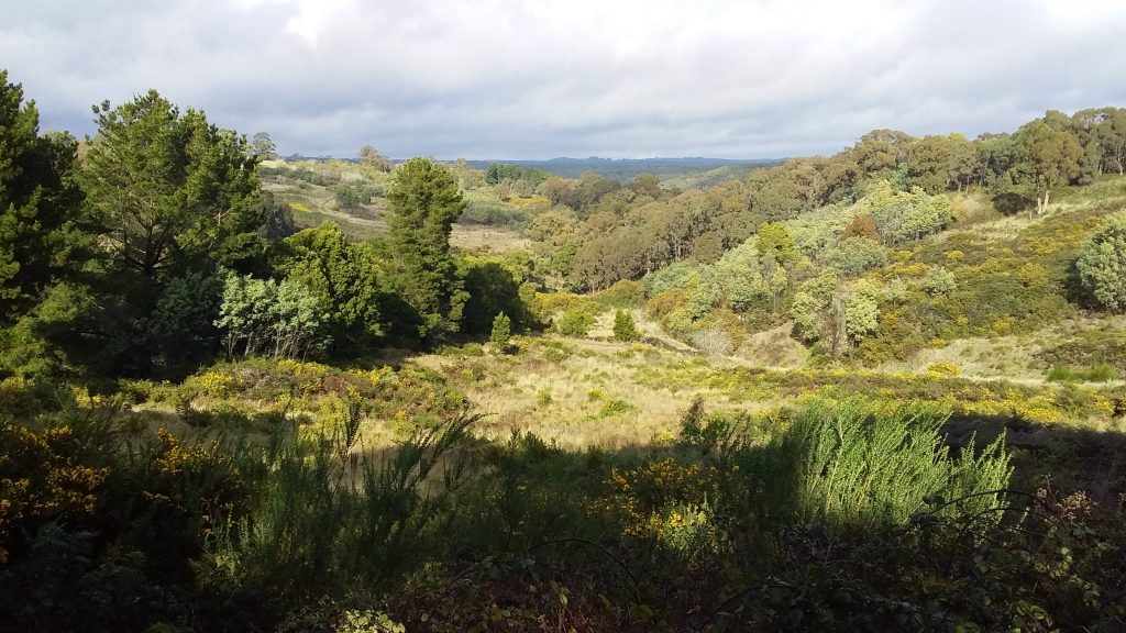
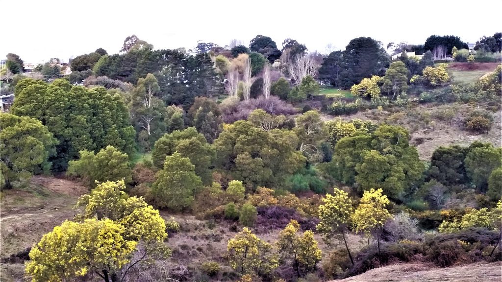
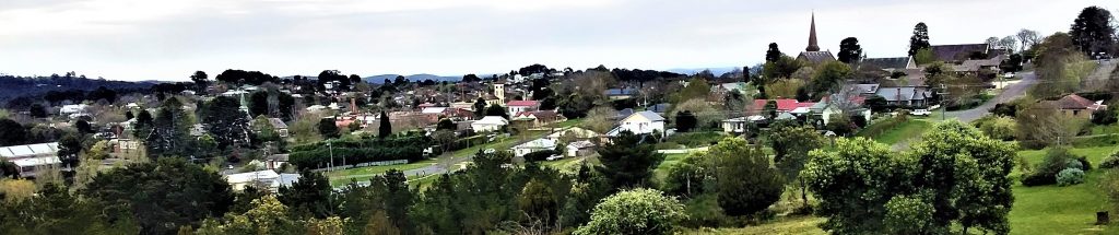
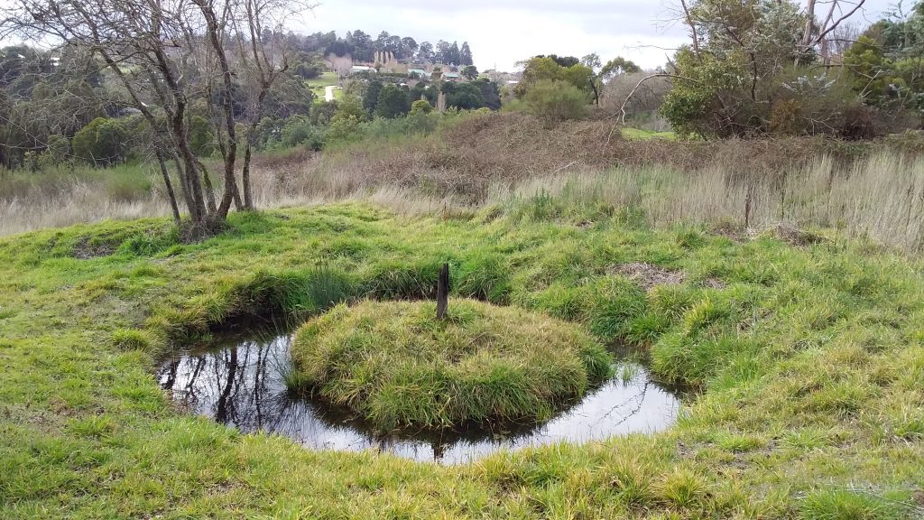

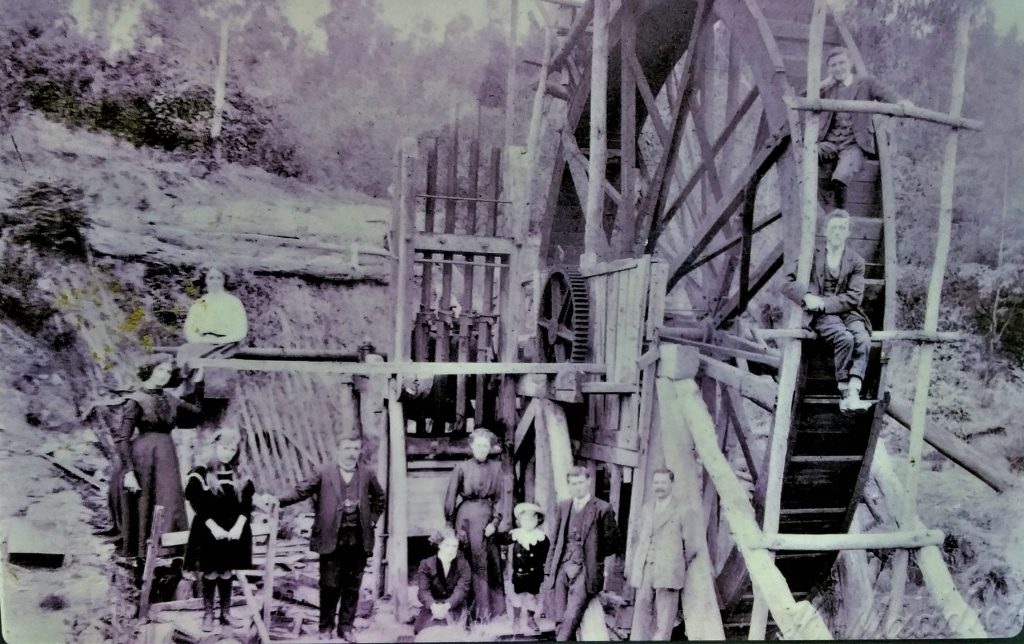
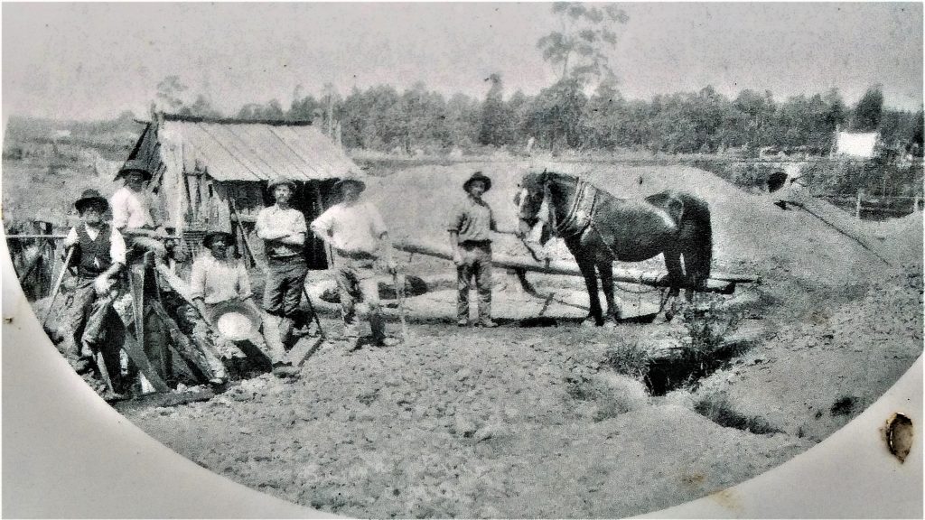


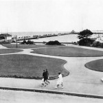


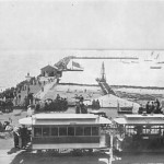


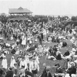
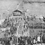


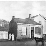


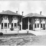


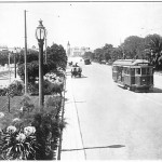


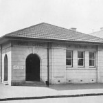


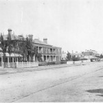


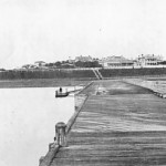
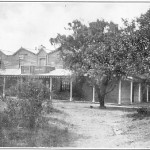


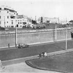

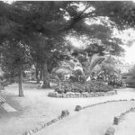
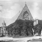


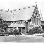


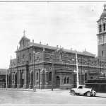


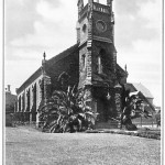
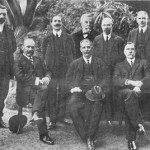


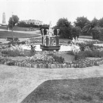
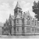
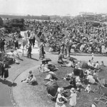


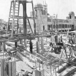


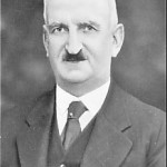
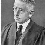


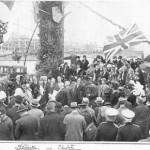
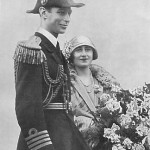
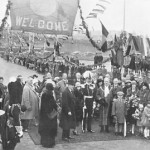


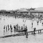


 Church of England, Presbyterians, Roman Catholics and one acre each was given to the Jews, Quakers, Methodists and Independents. Later half the Quaker section was allocated to the Aborigines. We visit each section and read the inscriptions for former headstones and discuss key personalities and events.


